West Highland Way: Trailblazer Ochils and Campsie Fells

 Bearsden & District

Campsie Fells

West Highland Way - Map West Highland Way: Footprint Map


Photographs of an ascent of Dumgoyne in the Campsie Fells

above Glengoyne Distillery

Dumgoyne and the Campsie Fells


Dumgoyne


Dumgoyne and the Campsie Fells


Glengoyne Distillery at the foot of Dumgoyne and the Campsie Fells

Glengoyne Distillery

at the foot of  Dumgoyne and the 
Campsie Fells


Dumgoyne in the Campsie Fells


Auchineden Hill on ascent of Dumgoyne

Auchineden Hill ( The Whangie )

on ascent of  Dumgoyne


The Campsie Fells from Dumgoyne


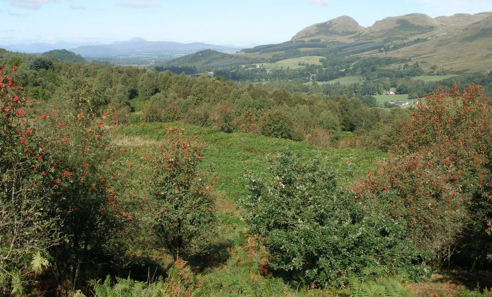
Luss Hills above Loch Lomond from Dumgoyne and the Campsie Fells


Ben Lomond from Dumgoyne and the Campsie Fells

 Ben Lomond from Dumgoyne

in the 
Campsie Fells

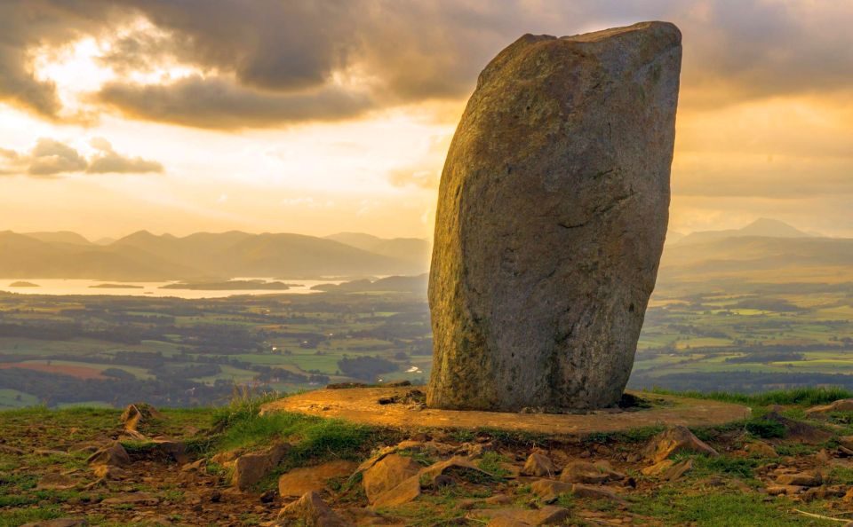
The Standing Stone at the summit of Dumgoyne.

The stone was helicoptered into placed

 by the Strathendrick Rotarians


Luss Hills and Loch Lomond from Dumgoyne


View to the North from the Campsie Fells

View to the North

from the 
Campsie Fells


Earl's Seat from Dumgoyne

Earl's Seat ( the highest point of the Campsie Fells )

from Dumgoyne 


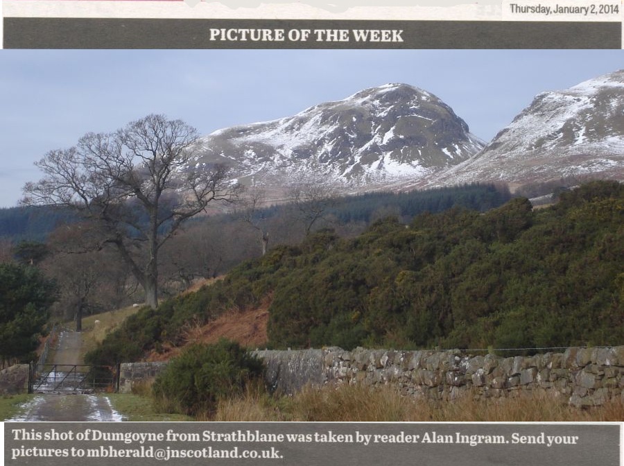
Dumgoyne and the Campsie Fells from Strathblane


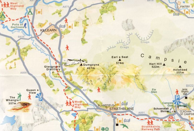
Map of Dumgoyne and West Highland Way

Map of Dumgoyne and West Highland Way


Map of Dumgoyne and West Highland Way

Map of Dumgoyne and West Highland Way


DUMGOYNE ROUTE - DESCRIPTION:-


Dumgoyne, is an iconic landmark at the end of the Campsie Fells above Glengoyne Distillery just six miles north of Milngavie.
The straightest and shortest way to climb it is to start from the distillery and walk directly uphill. The path is clear but very steep especially when it ascends the bluff immediately below the summit.
This route to Dumgoyne approaches more gradually from the north side of the hill and is a distance of approximately five and a half miles from Killearn where there is a small car park on the other side of the road from the local Cooperative ( which also has a car park ).
From the car park walk into the village for 200 yards to a road on the right immediately before the Spar shop.
Turn right up this road; at a bend before Ibert Farm turn right and go uphill. Turn right again, passing the large house called Auchenibert and follow the road past various houses and through woodland until it reaches a gate beyond which lies grassland and moor.
Follow the flat grassy track for about half a mile until you come to a clear track on your left. It is ared gravelly soil path and leads gradually uphill. Below you on the right is a group of farm buildings - High Lettre Farm. Take the red track which heads in the general direction of Dumgoyne which is clearly visible. The track zigzags uphill making the climb reasonably gentle. It's also dry and firm underfoot and is graded to allow for rainwater run-off. As you climb the view gradually widens to encompass the southern part of Loch Lomond, Ben Lomond and the Arrochar Alps, and the range of mountains and hills in the Trossachs. Closer to hand you look down on a wide heather-strewn moor. Beyond the moor are the villages of
Killearn and Balfron. Dumgoyne has become invisible, hidden by the ridge of the hillside that you have been traversing.
Eventually the track divides with one on the left taking a long sweep northwards; there are long stretches of deer fencing on that side - perhaps it is deer hunting and grouse shooting ( there are grouse butts on the hillside ) that has made it worthwhile to surface the track for vehicles.
Take the right hand  branch that heads round towards Dumgoyne that has now come into sight again.
At the end of this branch of the track a path winds up to the ridge between Dumgoyne and Earl's Seat, the highest point in the Campsies.
A steep ascent from the col then gains the summit of Dumgoyne and a fine viewpoint.


The Campsie Fells:- ( Photo Gallery Thumbnail Gallery )

<< BackBearsden Index : Next >>


Scotland Index :: Scottish Peaks :: Scotland Walks

Glencoe | Ben Nevis | Knoydart | Isle of Skye | Isle of Arran

The Eastern Highlands | The Central Highlands | The Southern Highlands | The NW Highlands


Adventure Travel : Worldwide Mountaineering : Site Index

fb icon  google+ icon Linkedin icon  twitter


Guide Books & Maps - Scotland:-


West Highland Way: Footprint MapWest Highland Way - Map West Highland Way - Map Western Scotland & the Western Isles OS Road Map Northern Scotland OS Road MapSouthern Scotland OS Road Map Glasgow Popular Hills - Map


Ochils and Campsie Fells

Glasgow Visitor Guide - Colin Baxter Itchy Insider's Guide to Glasgow Glasgow Footprint Pocket Guide Glasgow Insight Pocket Guide Glasgow Guide Pub Companion Glasgow Scotland's Highlands & Islands - Rough Guide Scotland - Rough Guide

Glasgow Insight Pocket GuideCollins Street Map of GlasgowGlasgow: Then & NowThey belonged to Glasgow Phillips Street Atlas of Glasgow & West Central Scotland Glasgow: The Photographic Atlas100 Hillwalks around Glasgow 50 Walks in Glasgow & SW Scotland

Visit Scotland - Touring Guide Scotland: Where to Stay - Hotels & Guest Houses Scotland: Where to Stay - Bed & Breakfast Rough Guide ScotlandScottish Highlands & Islands - Rough Guide Scotland - Lonely PlanetScotland's Highlands & Islands - Lonley Planet Great Glasgow StoriesGlasgow & Surroundings - Insight Guide

West Highland Way: Official GuideWest Highland Way: Rucksac ReadersWest Highland Way: Trailblazer The West Highland WayWest Highland Way: Footprint MapWest Highland Way - Map West Highland Way - Map West Highland Way Wet Highland Way - Official Guide

Munro Almanac The High Mountains of Britain and Ireland The Munros: Scottish Mountaineering Club The Isle of Skye The Isle of Arran Wilderness Walks Ski Mountaineering in Scotland

More Wilderness Walks 50 Best Routes on Skye and Raasay Skye - W.A.PoucherMagic of the Munros Mountaineering in Scotland and Undiscovered Scotland by W.H.Murray A Long Walk on the Isle of Skye

Classic Climbs - Central & Southern Highlands The Isle of Arran Lonely Planet, Walking in ScotlandPathfinder Guide: Skye and NW Highlands WalksPathfinder Guide: Fort William and Glen Coe Walks Rambler's Guide: Ben Nevis and Glen Coe50 Best Routes on Skye and Raasay - Chris Townsend


Google Analytics


Google Analytics

extremetracking
 eXTReMe Tracker


extremetracking
Sitelock caingram.com
SiteLock
Sitelock
Sitelock caingram.info
SiteLock
Sitelock