West Highland Way: Trailblazer Ochils and Campsie Fells

 Bearsden & District

Milton of Campsie

West Highland Way - Map West Highland Way: Footprint Map


Photographs of the walk from Lennoxtown 

along the Thomas Muir Trail / Strathkelvin Railway Path

 beneath the Campsie Fells to
Milton of Campsie

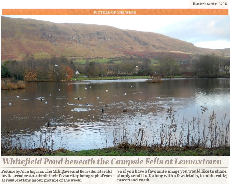
Campsie Fells above Whitefield Pond in Lennoxtown

Campsie Fells above Whitefield Pond

in Lennoxtown

Whitefield Pond was constructed in the 1800s

to supply clean water to the Lennox Mill Printworks.

The pond is home to many waterbirds and other wildlife.


Clachan of Campsie beneath the Campsie Fells in winter

Campsie Fells

above Whitefield Pond in winter


Junction in Lennoxtown at the start of the Crow Road over the Campsie Fells

Junction in Lennoxtown

at the start of the Crow Road

 over the
Campsie Fells


Parish Church in Lennoxtown

Parish Church

 in Lennoxtown


Glazert Water from the Thomas Muir Trail to Lennoxtown

Glazert Water from the Thomas Muir Trail

 from Lennoxtown to Milton of Campsie

Between Lennoxtown
and Milton of Campsie

 
the route follows the Strathkelvin Railway Path


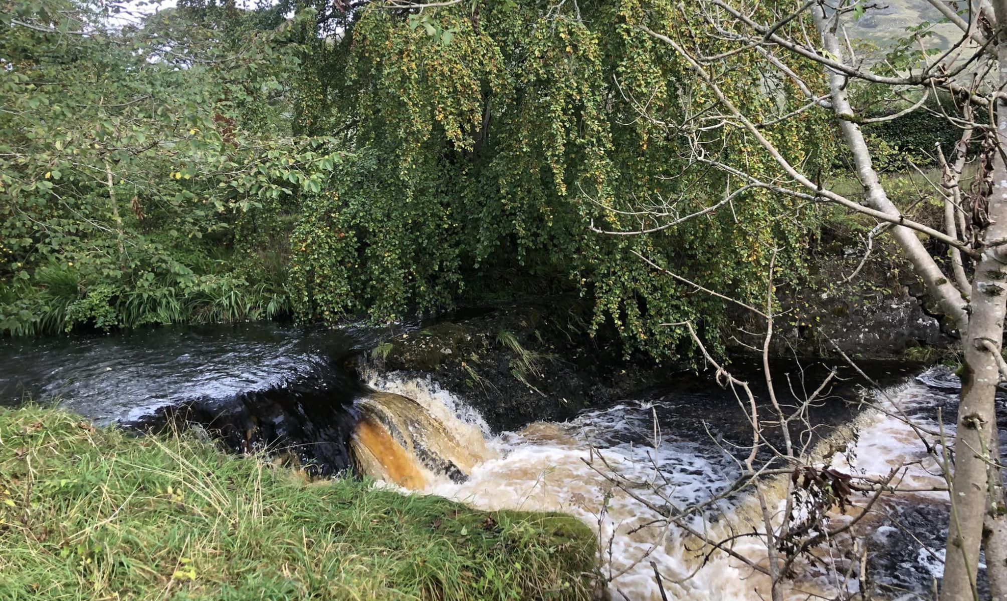
Glazert Water from the Thomas Muir Trail to Lennoxtown

Waterfall on Glazert Water

from the Thomas Muir Trail

 from Lennoxtown to Milton of Campsie


Bridge over the Thomas Muir Trail

Signpost

 on the
Thomas Muir Trail


View from the Thomas Muir Trail from Lennoxtown to Milton of Campsie

 View from the Thomas Muir Trail

 from Lennoxtown to Milton of Campsie


View from the Thomas Muir Trail from Lennoxtown to Milton of Campsie

 View from the Thomas Muir Trail

 from Lennoxtown to Milton of Campsie


Bridge over the Thomas Muir Trail at Milton of Campsie

Bridge over the Thomas Muir Trail

 at Milton of Campsie


Road Bridge at Milton of Campsie

Road Bridge

 at Milton of Campsie


Parish Church in Milton of Campsie

Parish Church

 in
Milton of Campsie


Parish Church in Milton of Campsie

Parish Church

 in
Milton of Campsie


The Post Office in Milton of Campsie

The Post Office in Milton of Campsie

Milton of Campsie is a small village

 in East Dunbartonshire

 in the Central Belt of Scotland

It is some 10 miles to the north of Glasgow


"The Fells" Coffee House in Milton of Campsie

"The Fells" Coffee House

 in
Milton of Campsie


"Old Man's Rest" in Milton of Campsie

Plaque at "Old Man's Rest" in Milton of Campsie

"Old Man's Rest"

 in
Milton of Campsie  


McDowall's & Co. mills in 1800 on the Glazert Water at Milton of Campsie

 McDowall's & Co. mills in 1800

 
on the Glazert Water

 
at Milton of Campsie


Glazert Water at Milton of Campsie

Glazert Water

 
at Milton of Campsie


Playing field in Milton of Campsie

Playing field

 in
Milton of Campsie


Campsie Fells above Milton of Campsie

Campsie Fells

above 
Milton of Campsie


Campsie Fells above Milton of Campsie

Campsie Fells

above 
Milton of Campsie


Campsie Fells above Antermony Loch


Antermony Loch from Laird's Hill


Map of Milton of Campsie beneath the Campsie Fells

Map of Milton of Campsie

 beneath the Campsie Fells

Milton of Campsie Gallery Photo Gallery :: Lennoxtown Gallery Photo Gallery :: Campsie Fells Photo Gallery

<< Back : Bearsden Index : Next >>


Scotland Index :: Scottish Peaks :: Scotland Walks

Glencoe | Ben Nevis | Knoydart | Isle of Skye | Isle of Arran

The Eastern Highlands | The Central Highlands | The Southern Highlands | The NW Highlands


Adventure Travel : Worldwide Mountaineering : Site Index

fb icon google+ icon  Linkedin icon  twitter


Guide Books & Maps - Scotland:-


West Highland Way: Footprint MapWest Highland Way - Map West Highland Way - Map Western Scotland & the Western Isles OS Road Map Northern Scotland OS Road MapSouthern Scotland OS Road MapGlasgow Popular Hills - Map


Ochils and Campsie Fells

Glasgow Visitor Guide - Colin Baxter Itchy Insider's Guide to Glasgow Glasgow Footprint Pocket Guide Glasgow Insight Pocket Guide Glasgow Guide Pub Companion Glasgow Scotland's Highlands & Islands - Rough Guide Scotland - Rough Guide

Glasgow Insight Pocket GuideCollins Street Map of GlasgowGlasgow: Then & NowThey belonged to Glasgow Phillips Street Atlas of Glasgow & West Central Scotland Glasgow: The Photographic Atlas100 Hillwalks around Glasgow 50 Walks in Glasgow & SW Scotland

Visit Scotland - Touring Guide Scotland: Where to Stay - Hotels & Guest Houses Scotland: Where to Stay - Bed & Breakfast Rough Guide ScotlandScottish Highlands & Islands - Rough Guide Scotland - Lonely PlanetScotland's Highlands & Islands - Lonley Planet Great Glasgow StoriesGlasgow & Surroundings - Insight Guide

West Highland Way: Official GuideWest Highland Way: Rucksac ReadersWest Highland Way: TrailblazerThe West Highland WayWest Highland Way: Footprint MapWest Highland Way - Map West Highland Way - Map West Highland Way Wet Highland Way - Official Guide

Munro Almanac The High Mountains of Britain and Ireland The Munros: Scottish Mountaineering Club The Isle of Skye The Isle of Arran Wilderness Walks Ski Mountaineering in Scotland

More Wilderness Walks 50 Best Routes on Skye and Raasay Skye - W.A.PoucherMagic of the Munros Mountaineering in Scotland and Undiscovered Scotland by W.H.MurrayA Long Walk on the Isle of Skye

Classic Climbs - Central & Southern Highlands The Isle of Arran Lonely Planet, Walking in ScotlandPathfinder Guide: Skye and NW Highlands WalksPathfinder Guide: Fort William and Glen Coe Walks Rambler's Guide: Ben Nevis and Glen Coe50 Best Routes on Skye and Raasay - Chris Townsend


Google Analytics


Google Analytics

extremetracking
 eXTReMe Tracker


extremetracking
Sitelock caingram.com
SiteLock
Sitelock
Sitelock caingram.info
SiteLock
Sitelock