West Highland Way: Trailblazer Ochils and Campsie Fells

 Bearsden & District

Lennoxtown

West Highland Way - Map West Highland Way: Footprint Map


Photographs of a circular walk from the Clachan of Campsie

 through Schoenstatt,

along the Thomas Muir Trail to Lennoxtown

 then climbing to Lennox Forest

 and returning via Lennox Castle

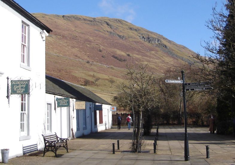
Clachan of Campsie beneath the Campsie Fells

Clachan of Campsie

 
beneath the Campsie Fells


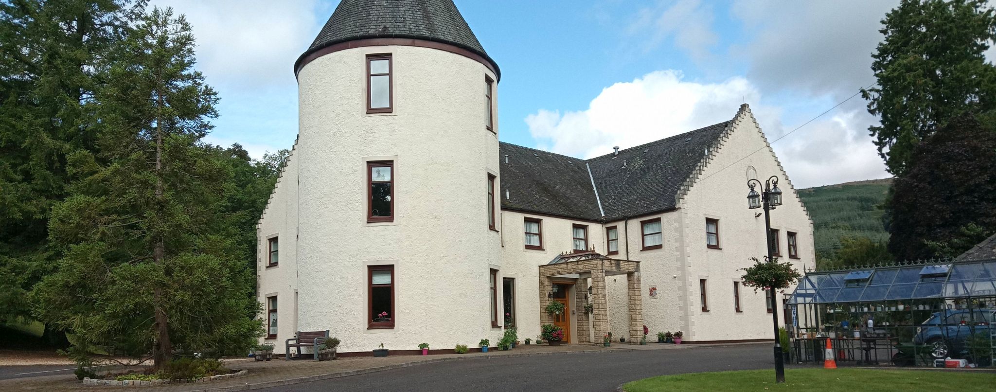
Schoenstatt beneath the Campsie Fells

Schoenstatt beneath the Campsie Fells

Origininally Ballencleroch House,

Schoenstatt ( "
beautiful place ")

 is named after a village near Koblenz

 in Germany.

 Schoenstatt is a
Roman Catholic Movement

 that
emphasizes a devotion to the Virgin Mary.

 There is a woodland walk within Schoenstatt


Schoenstatt beneath the Campsie Fells


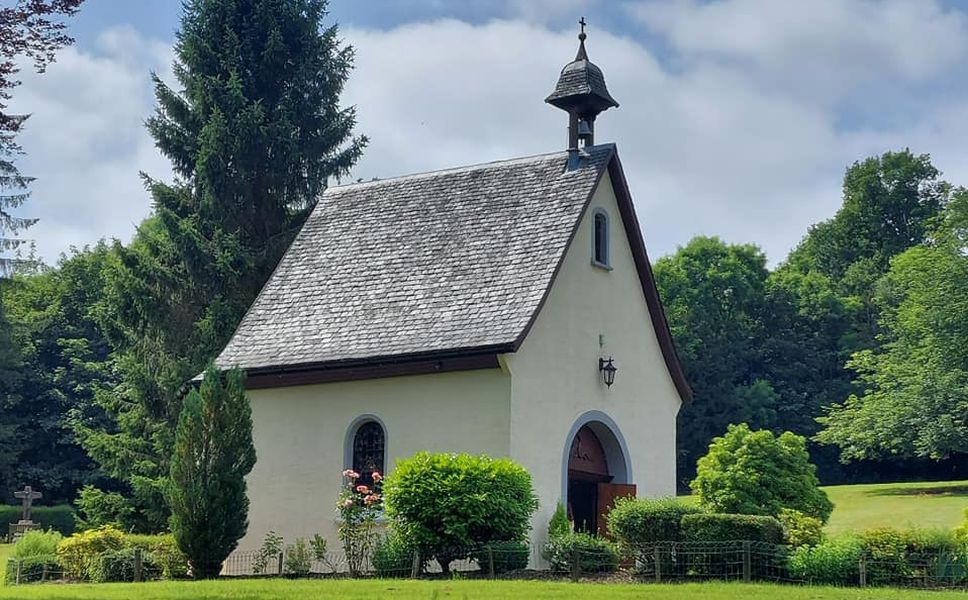
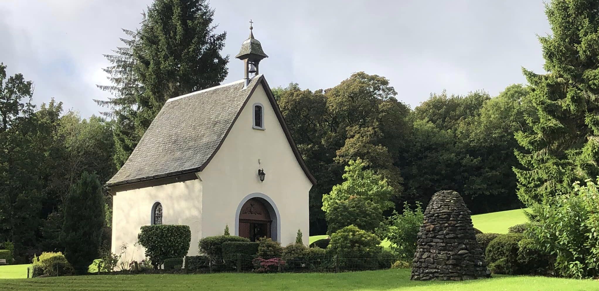
Chapel at Schoenstatt


Chapel at Schoenstatt


Woodland walk beside the Campsie Glen Burn through Schoenstatt

Woodland walk

 beside the Campsie Glen Burn

 through Schoenstatt


Campsie Fells from the Thomas Muir Trail to Lennoxtown

Campsie Fells

from the Thomas Muir Trail to Lennoxtown

Between Clachan of Campsie and Lennoxtown

 the route follows the Strathkelvin Railway Path


Bridge over the Thomas Muir Trail

Bridge over the Thomas Muir Trail


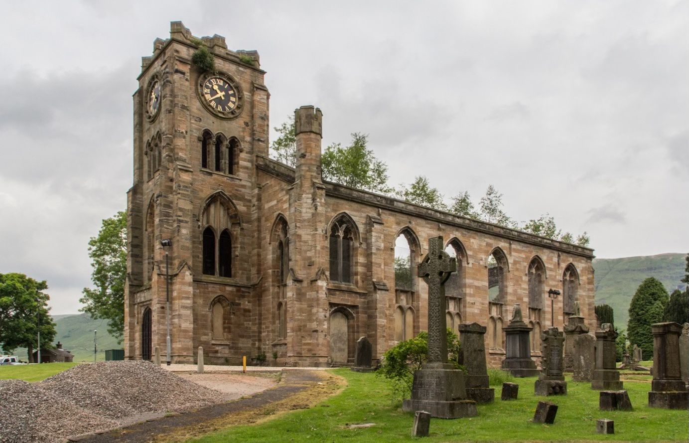
The High Kirk in Lennoxtown beneath the Campsie Fells

The High Kirk in Lennoxtown

 beneath the Campsie Fells


from the
Thomas Muir Trail


The High Kirk in Lennoxtown

The High Kirk in Lennoxtown


The High Kirk in Lennoxtown

The High Kirk in Lennoxtown


The High Kirk in Lennoxtown

The High Kirk in Lennoxtown


Entrance Gateway War Memorial to the The High Kirk in Lennoxtown

Entrance Gateway War Memorial

 to the The High Kirk


The Primary School in Lennoxtown

The Primary School

in Lennoxtown


Lennoxtown beneath Cort-ma Law on the Campsie Fells

Lennoxtown beneath Cort-ma Law

on the
Campsie Fells 


Sign at Lennox Forest above Lennoxtown

Sign at Lennox Forest

 above Lennoxtown


Lochan in Lennox Forest above Lennoxtown

Lochan

in Lennox Forest


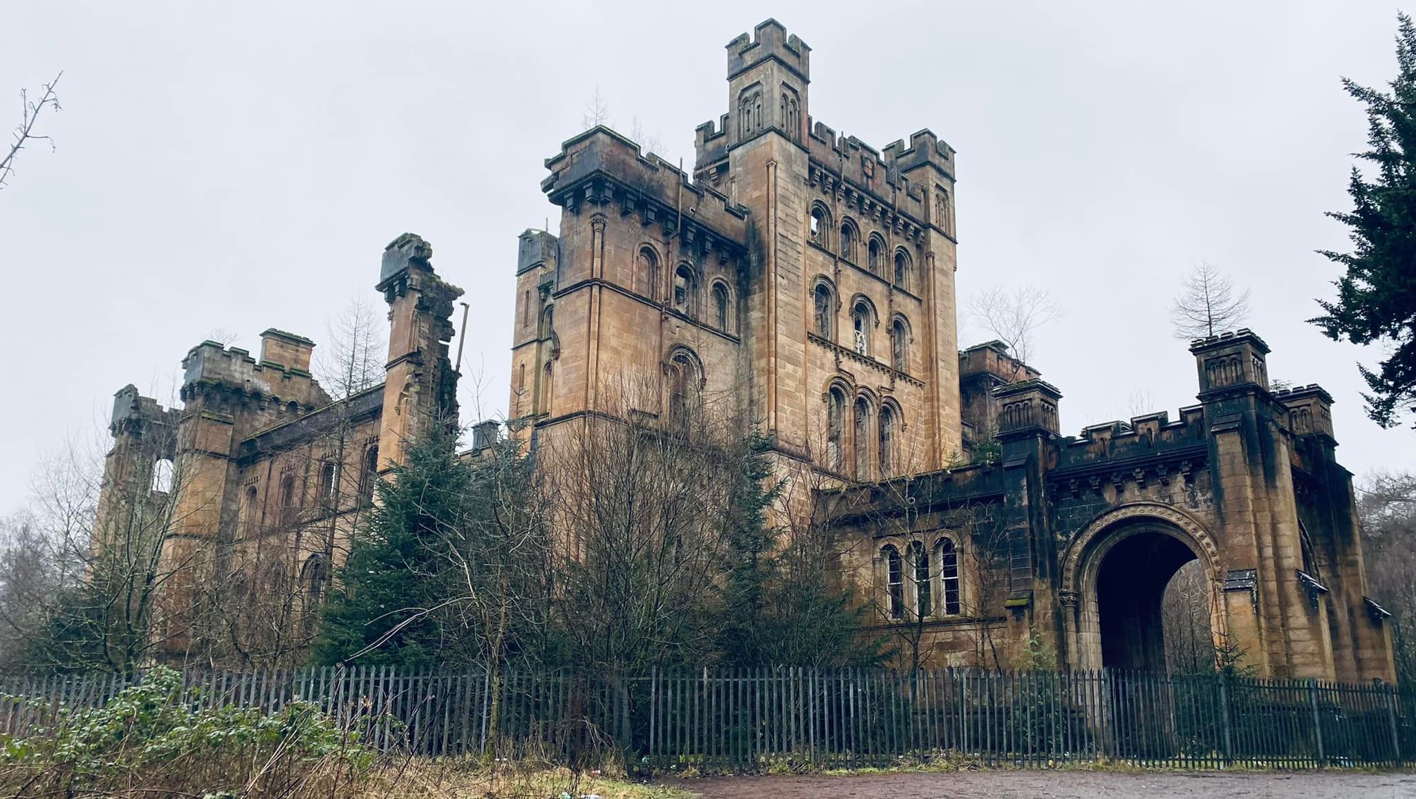
Lennox Castle above Lennoxtown

Lennox Castle above Lennoxtown

Lennox Castle was built
between 1837 and 1841

 by John Lennox Kincaid.

In April 1925 Glasgow Parish Council resolved to build


a new Mental Deficiency Institution


under the provisions of the 1913 Act.


In 1927 the castle and its estate


were purchased and plans drawn up


for what was intended to be the largest


and best equipped hospital of its type in Britain.


Providing 1,200 beds at the cost of £1.25m,


work began converting the estate


to the designs of Wylie, Shanks and Wylie.


Lennox Castle itself was adapted into a nurses home.


Later requisitioned under the Emergency Hospital Scheme,


with ward huts constructed near the Castle, during WW2.


A maternity unit was subsequently established


on the site in 1941


which operated until 1964.


In 1987, the castle,


previously used for nurses' accommodation,


was vacated.


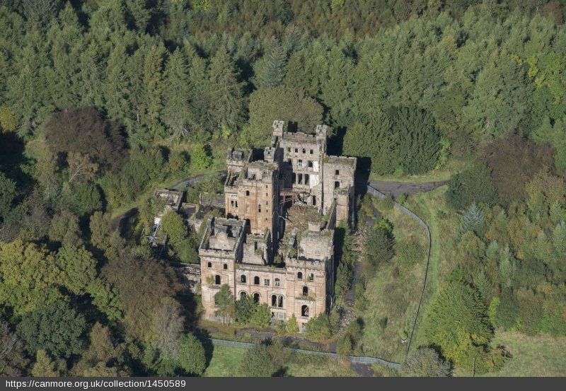
Aerial view of Lennox Castle above Lennoxtown

Aerial view of Lennox Castle

 above Lennoxtown.

Lennox Castle was built

between
1837 and 1841

 by John Lennox Kincaid 


Aerial view of Lennox Castle above Lennoxtown

Aerial view of Lennox Castle

 above Lennoxtown.

Lennox Castle was built

between
1837 and 1841

 by John Lennox Kincaid 


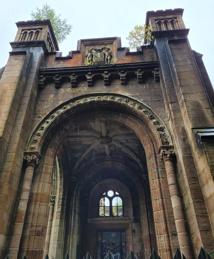
Lennox Castle above Lennoxtown


Lennox Castle above Lennoxtown


Lennox Castle above Lennoxtown


Lennox Castle above Lennoxtown


Lennox Castle above Lennoxtown


Campsie Glen and the Crow Road over the Campsie Fells above Lennoxtown

Campsie Glen and the Crow Road

 over the Campsie Fells


 above Lennoxtown


Snow-covered Campsie Fells above Lennoxtown

 Snow-covered Campsie Fells

above Lennoxtown


Whitefield Pond in Lennoxtown

Campsie Fells

above Whitefield Pond

in Lennoxtown


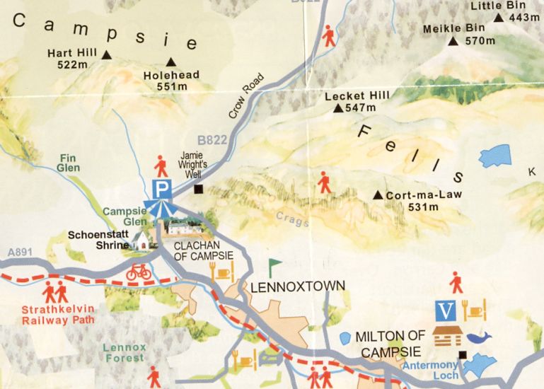
Map of the Thomas Muir Trail from Clachan of Campsie to Lennoxtown

Map of the Thomas Muir Trail

from Clachan of Campsie to Lennoxtown


Map of Lennoxtown beneath the Campsie Fells

Map of Lennoxtown

beneath the Campsie Fells


Lennox Forest Walk

Lennox Castle Walk


LENNOXTOWN CIRCULAR WALK  - ROUTE DESCRIPTION:


This walk is around four miles and is from the Clachan of Campsie along the lowerground around Lennox Forest.
The walk starts at the side of the Glazert Country House Hotel off Milton Road in Lennoxtown and follows the
sign to the Strathkelvin Railway Path. It crosses the road bridge over the Glazert Water and then over the Railway Path before turning right onto the signed, “Footpath to Station Road’, a narrow path through a wood which runs parallel to the Glazert and the Railway Path. At the end of the wood, the walk crosses Station Road and continues on an open country road with beech hedges on either side. It passes Balglass Farm on the right with a lovely view looking over to the Campsie Fells before entering Lennox Castle Estate through 2 sets of stone pillars. The lodge between the stone pillars was at one time occupied by a resident doctor and the houses to the right were for hospital staff.
Continuing ahead and up hill. the walk passes Darnley House on the left, a lovely brick facing mansion, and after crossing the bridge over the burn it turns left still uphill to pass the side of the luxrious Celtic Football Training Ground. It then passes “The White House‘ on the left and after going round the low green gate it turns right at the Y-junction onto a straight road bordered by rhododendron bushes and above the Training Ground. At the next junction, the walk goes round the facing high gate fence and enters a driveway which is lined with more mature rhododendron bushes and which drops down gradually to the ruined Lennox Castle. Leaving the Castle, the walk continues on the main driveway and winds its way down through a delightful avenue of trees. lt changes onto a narrow path at the bottom and then crosses a wide stone walled bridge over the Glazert and into a wood. Coming out of the wood, the walk turns right onto the Strathkelvin Railway Path with its many interesting points of note. It passes the path which returns to the start of the Thomas Muir Trail at the Clachan of Campsie and continues across the walkway over the Campsie Burn to the road entrance of the new housing development and Celtic Training Ground.
Alter crossing the road and turning left for a short distance, the walk re-enters the Railway Path on the right. Initially it is surrounded by trees as it meets again the Thomas Muir Trail, passes under the first roadbridge and links up with the Glazert as it flows alongside. The trees gradually thin out on the left side with new housing and after passing under the second roadbridge for Station Road. open ground appears with the grass and blaes football pitches. The Railway Path then crosses once again a footbridge over the Glazert and the walk follows the Glazert on the other side and through another wood. On reaching the zig-zag barrier it finally turns left off the Railway Path and
returns to the start beside the Glazert Country House Hotel.


Lennoxtown Gallery Photo Gallery :: Dumgoyne & Campsie Fells Photo Gallery

<< Back : Bearsden Walks Index : Next >>


Scotland Index :: Scottish Peaks :: Scotland Walks

Glencoe | Ben Nevis | Knoydart | Isle of Skye | Isle of Arran

The Eastern Highlands | The Central Highlands | The Southern Highlands | The NW Highlands


Adventure Travel : Worldwide Mountaineering : Site Index

fb icon  google+ icon Linkedin icon  twitter


Guide Books & Maps - Scotland:-


West Highland Way: Footprint MapWest Highland Way - Map West Highland Way - Map Western Scotland & the Western Isles OS Road Map Northern Scotland OS Road MapSouthern Scotland OS Road MapGlasgow Popular Hills - Map


Ochils and Campsie Fells

Glasgow Visitor Guide - Colin Baxter Itchy Insider's Guide to Glasgow Glasgow Footprint Pocket Guide Glasgow Insight Pocket Guide Glasgow Guide Pub Companion Glasgow Scotland's Highlands & Islands - Rough Guide Scotland - Rough Guide

Glasgow Insight Pocket GuideCollins Street Map of GlasgowGlasgow: Then & NowThey belonged to Glasgow Phillips Street Atlas of Glasgow & West Central Scotland Glasgow: The Photographic Atlas100 Hillwalks around Glasgow 50 Walks in Glasgow & SW Scotland

Visit Scotland - Touring Guide Scotland: Where to Stay - Hotels & Guest Houses Scotland: Where to Stay - Bed & Breakfast Rough Guide ScotlandScottish Highlands & Islands - Rough Guide Scotland - Lonely PlanetScotland's Highlands & Islands - Lonley Planet Great Glasgow StoriesGlasgow & Surroundings - Insight Guide

West Highland Way: Official GuideWest Highland Way: Rucksac ReadersWest Highland Way: TrailblazerThe West Highland WayWest Highland Way: Footprint MapWest Highland Way - Map West Highland Way - Map West Highland Way Wet Highland Way - Official Guide

Munro Almanac The High Mountains of Britain and Ireland The Munros: Scottish Mountaineering Club The Isle of Skye The Isle of Arran Wilderness Walks Ski Mountaineering in Scotland

More Wilderness Walks 50 Best Routes on Skye and Raasay Skye - W.A.PoucherMagic of the Munros Mountaineering in Scotland and Undiscovered Scotland by W.H.MurrayA Long Walk on the Isle of Skye

Classic Climbs - Central & Southern Highlands The Isle of Arran Lonely Planet, Walking in ScotlandPathfinder Guide: Skye and NW Highlands WalksPathfinder Guide: Fort William and Glen Coe Walks Rambler's Guide: Ben Nevis and Glen Coe50 Best Routes on Skye and Raasay - Chris Townsend


Google Analytics


Google Analytics

extremetracking
 eXTReMe Tracker


extremetracking
Sitelock caingram.com
SiteLock
Sitelock
Sitelock caingram.info
SiteLock
Sitelock