Forth and Clyde Canal Exploring Edinburgh - Glasgow Canals

 Towns of Scotland

Linlithgow
Scotland - Lonely Planet Rough Guide Scotland

Photographs of the Historic Town of Linlithgow

in the central belt of Scotland


Linlithgow Palace

Linlithgow Palace

In the 15th and 16th centuries
the palace was one of the principal residences
 of the monarchs of Scotland.

It continued to be maintained
 after the monarchs left for England in 1603
but the palace was little used
 and
in 1746 was burned out.

It is now a visitor attraction
 in the care of Historic Scotland.


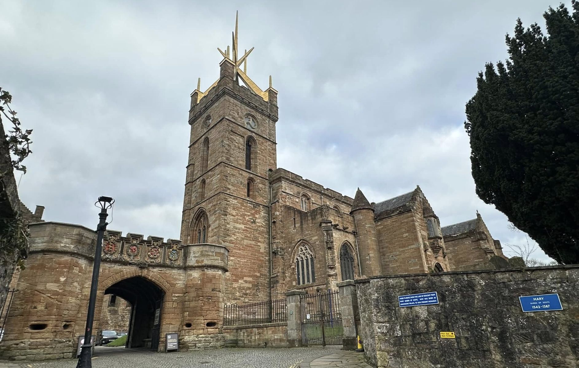
St Michael's Church at Linlithgow Palace

St Michael's Church

at Linlithgow Palace

The church was built on the site
 of an older church
 and was consecrated in 1242.

Following a fire in 1424
most of the present building dates
 from the mid 15th century
 with extensive restorations in the 19th century.
 
Parts of the Church of St Michael
were brought into use as they were completed
 and the church was completed in 1540.


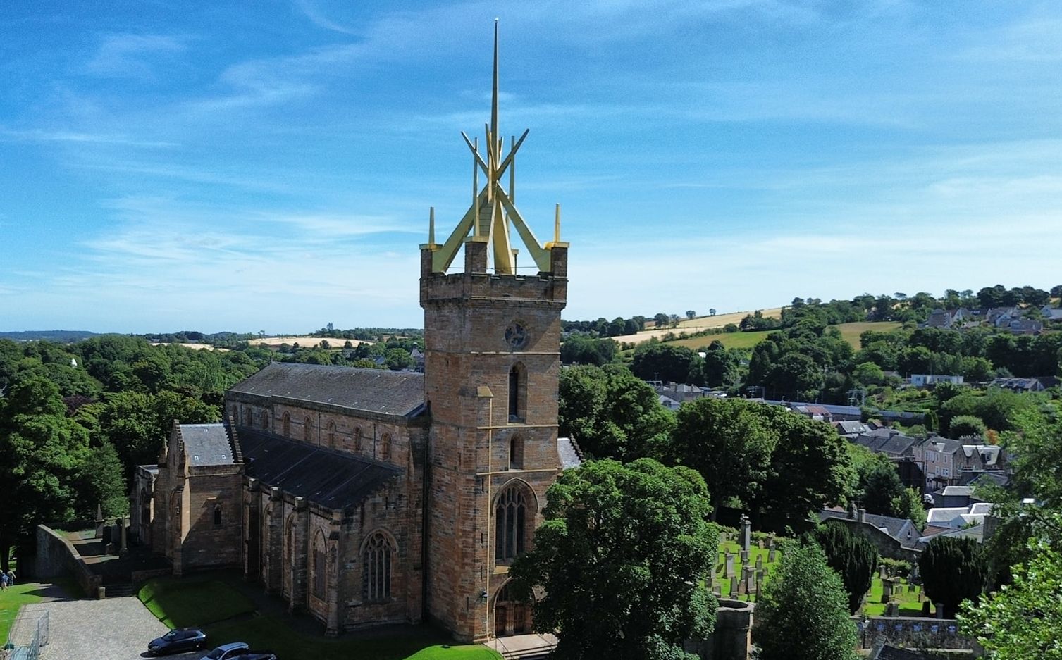
St Michael's Church at Linlithgow

St Michael's Church

at Linlithgow Palace


St Michael's Church at Linlithgow Palace

St Michael's Church

at Linlithgow Palace


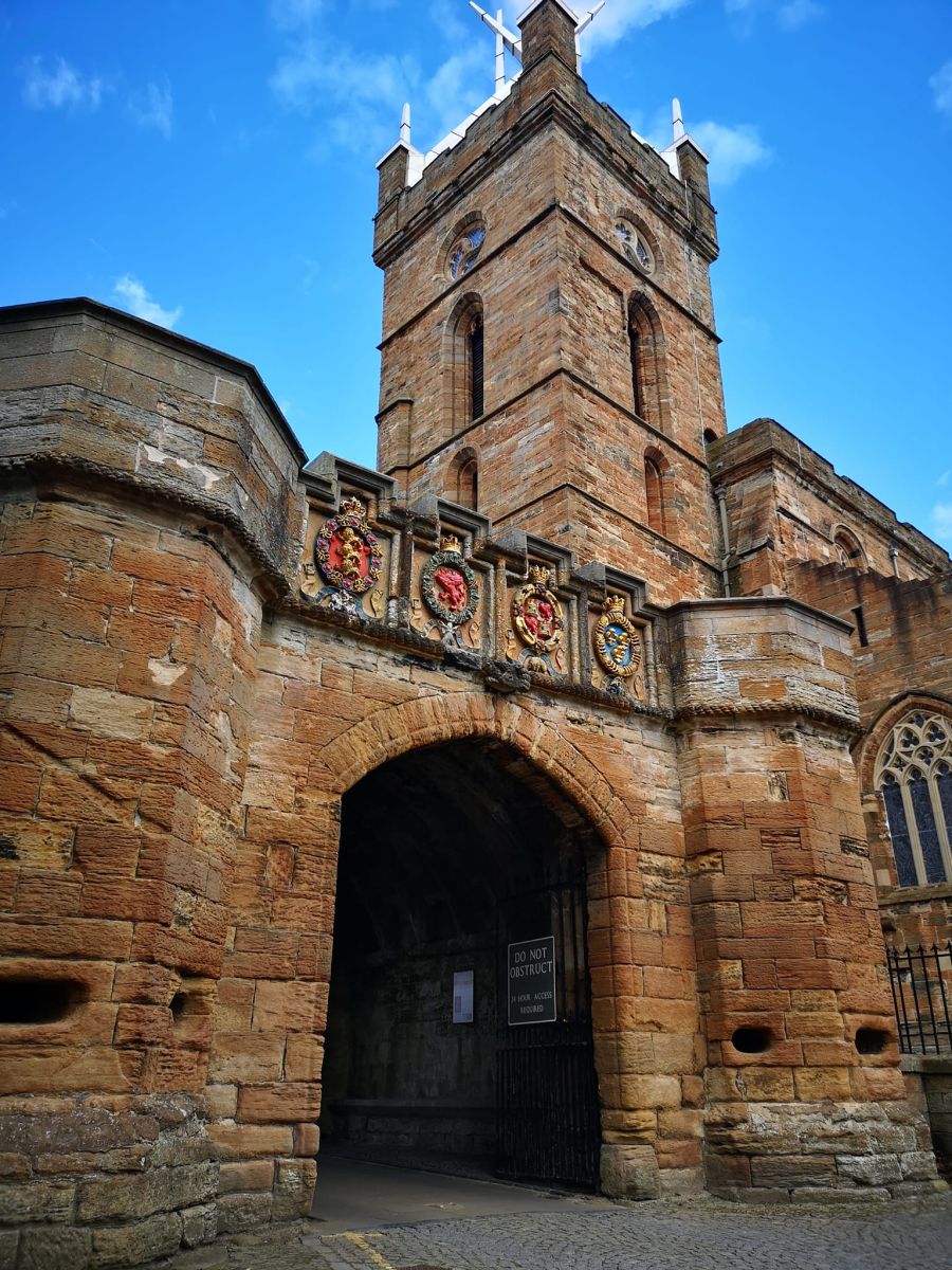
Entrance Gateway to Linlithgow Palace and St Michael's Church

Entrance Gateway

to Linlithgow Palace

and St Michael's Church


Entrance Gateway to Linlithgow Palace and St Michael's Church

Entrance Gateway

to Linlithgow Palace

and St Michael's Church


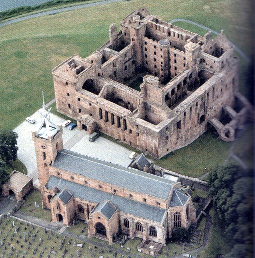
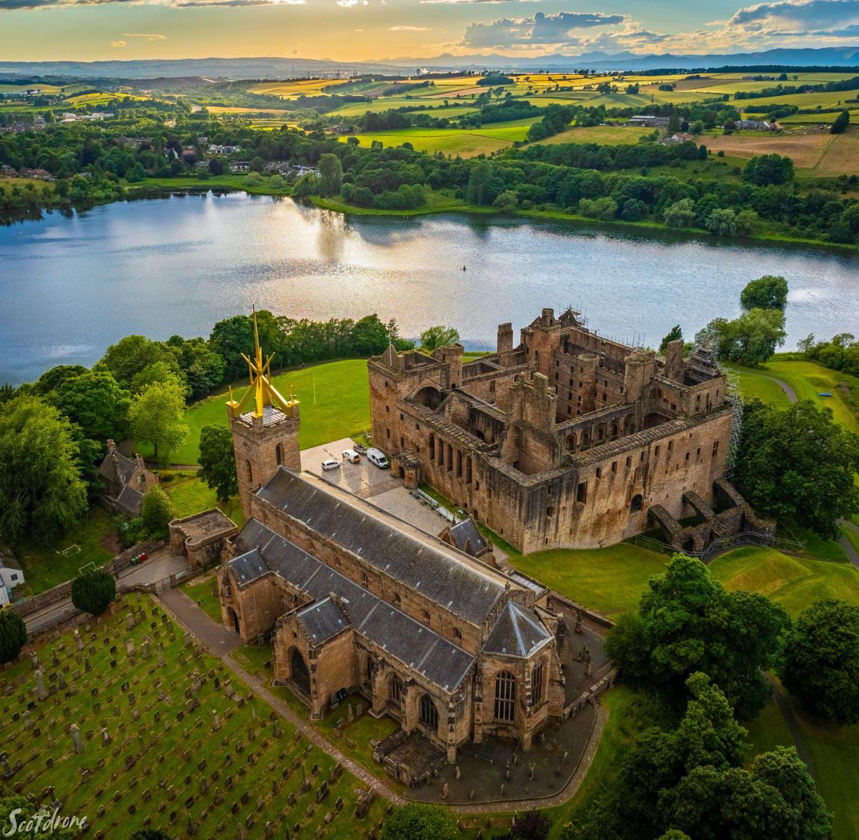
Aerial view of Linlithgow Palace

Aerial view of Linlithgow Palace

and St Michael's Church


Aerial view of Linlithgow Palace

Aerial view of Linlithgow Palace

and St Michael's Church


The Peel ( Park ) and Loch at Linlithgow Palace

The Peel ( Park ) and Loch

at Linlithgow Palace


St Michael's Church and Linlithgow Palace from the Peel

St Michael's Church

 and
Linlithgow Palace

 from the
Peel


Linlithgow Palace and St Michael's Church from the Loch

Linlithgow Palace

 
and St Michael's Church

 
from the Loch


Aerial view of Linlithgow Palace and St Michael's Church and the Loch

Aerial view of Linlithgow Palace

 
and St Michael's Church

 
and the Loch


Linlithgow Palace and St Michael's Church from the Loch illuminated at night

Linlithgow Palace

 
and St Michael's Church

 
from the Loch

 illuminated at night


Cockleroy Hill above Linlithgow from the Loch

Cockleroy Hill

 in Beecraigs Country Park

 above Linlithgow


Linlithgow from Cockleroy Hill in Beecraigs Country Park

Linlithgow from Cockleroy Hill

 in 
Beecraigs Country Park


The Town Hall in Linlithgow

The Town House (  1668 )
 in Linlithgow

This is one of the many historic buildings
 lining the High Street.


Shop in the High Street

Shop in the High Street 


The Black Bitch of Linlithgow

The Black Bitch of Linlithgow


The Primary School Building in Linlithgow

The Primary School Building ( 1900 )

 in Linlithgow


The Palace and St Michael's Church from the Union Canal running through Linlithgow

The Palace and St Michael's Church

from the Union Canal

running through Linlithgow


The Bridge Inn at Linlithgow Bridge

The Bridge Inn

at Linlithgow Bridge


The Avon Railway Viaduct from Linlithgow Bridge

  The Avon Railway Viaduct

from Linlithgow Bridge

The 442 yard 23 arch bridge
 was built in 1839-41

The viaduct is a category "A" listed building


The Avon Railway Viaduct

  The Avon Railway Viaduct

The 442 yard 23 arch bridge
 was built in 1839-41

The viaduct is a category "A" listed building


Location map for Linlithgow

Location map for Linlithgow


Map for walk around Linlithgow

Map of walk around Linlithgow

LINLITHGOW CIRCULAR WALK - ROUTE DESCRIPTION:


Location: West Loth|ian
Map: OS Landranger 65
Distance: 6miles (10km)
Time: 3-4 hours
Terrain: Canal tow path, riverside path and tarmac streets

There is something appealing about walking beside water, and this walk offers three variations on that theme - canal, river and loch.
The first section is along the Union Canal. Largely designed by Hugh Baird, the canal was opened in 1822. but when the railway arrived 20 years later it cut the journey time from Glasgow to Edinburgh from more than 12 hours to 2.5 hours, although the canal continued taking commercial traffic until 1933.
In recent times recreational interest has increased, and following the completion of the Millennium Link Project, the whole canal is open again. There are regular sailings from the basin in summer. The walk continues along the canal towpath. which is particularly well used by cyclists, who rarely give warning of their approach. The canal has plenty of birdlife. from swans to moorhens.
There are several major historic structures on the walk: the first of these is the Avon Aqueduct. Crossing the deep glen of the River Avon presented a real challenge to the canal builders and they turned to the greatest engineer of the day, Thomas Telford.
The result is the magnificent structure you see, the longest aqueduct in Scotland. With a length of 810ft (247m) and a maximum height of 85ft (215m), it carries the canal in a series of superb striding arches. It is worth walking across the aqueduct and back before continuing with the route below.
There is plenty to ponder as you leave the canal to walk beside the River Avon, which has many delightful little turns and tumbles. Before long you reach the 23-arch rail viaduct across the valley on the main line linking Edinburgh and Glasgow, which opened in 1842. lt is every hit as impressive as the aqueduct, and trains stiil use it.
A slightly complex jink through the houses (pay close attention to the directions and you won't go wrong) leads to Linlithgow Loch, which provides a superb foreground for the majestic Palace on its knoll, called The Peel. The loch is a designated Site Of Special Scientific Interest and the yellow water lilies at the south-east corner are said to have been flourishing for 400 years.
Linlithgow Palace is forever associated with Mary Queen Of Scots. who was born there in 1542. After the Union Of The Crowns in 1603 the Palace was much less used and Charles I was the last monarch to sleep there, in 1633. Bonnie Prince Charlie was there in 1745 and the following year, while occupied by the Duke Of Cumberlands troops, the Palace was seriously damaged by fire and was newer fully rebuilt.
Next to the Palace is St Mlchael’s Church. Originally dedicated in 1242, much of the existing building dates from the lfith century. Its aluminium ‘crown of thorns‘ is a very prominent landmark.
On the way back to the station you pass St Michael's Well, dated 1720 with the encouraging legend "St Michael is kind to straingers".


House of the Binns

House of the Binns


House of the Binns

House of the Binns


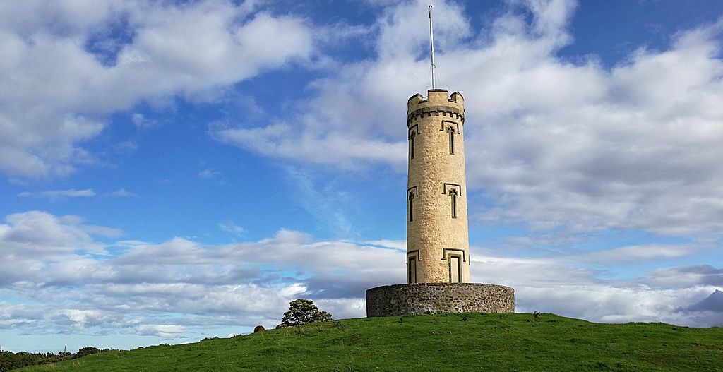
Tower at the House of the Binns

Tower at the House of the Binns


HOUSE OF THE BINNS

The House of the Binns provides walks, views, woodlands and a fine sprinkling of history, including some ghostly legends.

STORY QF THE GARDEN:

The house was built in 1612 by Thomas Dalyell, a prosperous Edinburgh Merchant who had made his fortune at the court of James VI.
He chose to site it north of Linlithgow, on the brow of a hill overlooking the River Forth and the grounds around it were laid out in
walks and rides, with views leading down to the river.

HIGHLIGHTS:

Binns Tower stands on the hill above the house. As garden ornaments go it is pretty impressive and the view even more so, taking in
the Pentlands, the Lomond hills in Fife and all three Forth bridges.
Paths lead to the tower and also criss-cross the meadows and woodlands that cover the wider estate.
And keep a look-out for a ghostly rider on a white stallion galloping along the road that leads to the main gate.

DON'T MISS:

The house is currently undergoing renovations, however this makeover is unlikely to be as extensive as the one that took place in 1633 when
elaborate plaster ceilings were commissioned for a visit by King Charles I.
But even when closed, the house provides an anchor for the designed landscape, which straddles both sides of the hill.
The original walled garden fell into disuse many years ago and the outline of the formal garden in front of the house
can still be seen on the ground.

ANYTHING ELSE TO LOOK OUT FOR:

The Sergeant’s Pond is where the Devil is reputed to have thrown a card table after an ill-fated game with “Bluidy Tam”, the
infamous General Tam Dalyell, who suppressed the Covenanters following the Pentland Rising in 1666 and founded the Royal Scots Greys.
During a drought in 1878 the pond dried up and a card table was found in its depths. The table was restored and returned to the house.

BEST TIME TO VlSlT:

In winter the views across the Forth are spectacular and in January, swathes of snowdrops appear beneath the trees.
These are followed by daffodils and in early summer the meadows are full of wildflowers.

RECOMMENDATIONS IN THE AREA:

The shallow waters of Linlithgow Loch provide food and habitat for ducks, swans and many other birds.
A path leads around the circumference and can be walked in less than an hour.
Two islands of the loch are believed to be the remains of crannogs, which early settlers constructed as places of safety more
than 5,000 years ago.


DIRECTIONS:

House of the Binns is near Old Philipstoun, on the A904 from the Forth Road Bridge to Linlithgow.


DETAILS:

The estate is open daily from 9am-7.30pm.
Entrance to the grounds is free.


 Linlithgow Gallery
Photo Gallery  :: Forth & Clyde Canal Gallery Photo Gallery

<< BackScotland Cities : Next >>


Scotland Index :: Scotland Walks :: Scotland Castles

Glencoe | Ben Nevis | Knoydart | Isle of Skye | Isle of Arran | The West Highland Way

The Eastern Highlands | The Central Highlands | The Southern Highlands | The NW Highlands


Adventure Travel : Worldwide Mountaineering : Site Index

fb icon  google+ icon  Linkedin icon  twitter


Guide Books & Maps - Scotland:-


Western Scotland & the Western Isles OS Road Map Northern Scotland OS Road MapSouthern Scotland OS Road MapGlasgow Popular Hills - Map


Scotland - Lonely PlanetScotland's Highlands & Islands - Lonley Planet Scotland's Highlands & Islands - Rough Guide Highlands & Islands of Scotland - Hidden Places Rough Guide ScotlandScottish Highlands & Islands - Rough Guide Rough Guide: Scotland Lonely Planet, Walking in Scotland100 Hillwalks around Glasgow

Walking Through Scotland - From the Border to Cape Wrath Dumfries & Galloway - 25 Walks Scottish Borders - 25 WalksSt.Cuthbert's Way - Official Guide Southern Uplands WaySouthern Uplands WaySouthern Upland WayWalking the Southern Upland Way Across Scotland on Foot

Ochils and Campsie Fells  The Pentland Hills  The Border Country  Galloway Hills


Forth & Clyde Canal  Forth and Clyde Canal Exploring Edinburgh - Glasgow Canals 

Glasgow - A Portrait   Wee Book of Glasgow  Glasgow from the Air  Glasgow - No Mean City  Lost Glasgow  Glasgow - The Real Gorbals Story    

Glasgow Visitor Guide - Colin Baxter Itchy Insider's Guide to Glasgow Glasgow Footprint Pocket Guide Glasgow Insight Pocket Guide Glasgow Guide Pub Companion Glasgow Scotland's Highlands & Islands - Rough Guide Scotland - Rough Guide

Glasgow Insight Pocket GuideCollins Street Map of GlasgowGlasgow: Then & NowThey belonged to Glasgow Phillips Street Atlas of Glasgow & West Central Scotland Glasgow: The Photographic Atlas100 Hillwalks around Glasgow 50 Walks in Glasgow & SW Scotland

Visit Scotland - Touring Guide Scotland: Where to Stay - Hotels & Guest Houses Scotland: Where to Stay - Bed & Breakfast Rough Guide ScotlandScottish Highlands & Islands - Rough Guide Scotland - Lonely PlanetScotland's Highlands & Islands - Lonley Planet Great Glasgow StoriesGlasgow & Surroundings - Insight Guide

West Highland Way: Official GuideWest Highland Way: Rucksac ReadersWest Highland Way: TrailblazerThe West Highland WayWest Highland Way: Footprint MapWest Highland Way - Map West Highland Way - Map West Highland Way Wet Highland Way - Official Guide

Munro Almanac The High Mountains of Britain and Ireland The Munros: Scottish Mountaineering Club The Isle of Skye The Isle of Arran Wilderness Walks Ski Mountaineering in Scotland

More Wilderness Walks 50 Best Routes on Skye and Raasay Skye - W.A.PoucherMagic of the Munros Mountaineering in Scotland and Undiscovered Scotland by W.H.MurrayA Long Walk on the Isle of Skye

Classic Climbs - Central & Southern Highlands The Isle of Arran Lonely Planet, Walking in ScotlandPathfinder Guide: Skye and NW Highlands WalksPathfinder Guide: Fort William and Glen Coe Walks Rambler's Guide: Ben Nevis and Glen Coe50 Best Routes on Skye and Raasay - Chris Townsend


extremetracking


extremetracking

Google Analytics


Google Analytics

extremetracking
 eXTReMe Tracker


extremetracking
Sitelock caingram.com
SiteLock
Sitelock
Sitelock caingram.info
SiteLock
Sitelock