Forth and Clyde Canal Exploring Edinburgh - Glasgow Canals

Linlithgow

  Beecraigs Country Park
Scotland - Lonely Planet Rough Guide Scotland

Photographs of Beecraigs Country Park

 near Linlithgow

in the central belt of Scotland


Deer in Beecraigs Country Park

Deer in Beecraigs Country Park

The 370 hectare Country Park
 is located in the Bathgate Hills
 above the historic town of Linlithgow.

Facilities available include woodland walks & trails,
a childrens' play area,
BBQ and picnic areas and a Ranger Service.

The Park is a AALA licensed outdoor activity centre for:-
 hillwalking, target & field archery,
canoeing & kayaking, rock-climbing, ski-ing,
orienteering, pioneering and team building sessions.

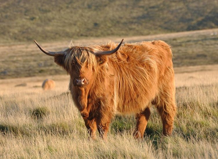
In the Park there are Highland Cattle and Red Deer.
Fly-fishing is allowed on Beecraigs Loch
and there is a caravan & camping site.

Cockleroy Hill offers superb panoramic views
 over the surrounding countryside.


Red Deer in Beecraigs Country Park

Red Deer


Highland Cattle in Beecraigs Country Park

Highland Cattle


Highland Cattle in Beecraigs Country Park

Highland Cattle


Fly-fishing on Beecraigs Loch in Beecraigs Country Park

Fly-fishing on Beecraigs Loch


Jetty on Beecraigs Loch

Jetty on Beecraigs Loch 


Pond at the BBQ area in Beecraigs Country Park

Pond at the BBQ area

 in Beecraigs Country Park


Woodlands in Beecraigs Country Park

Woodlands

 in
Beecraigs Country Park


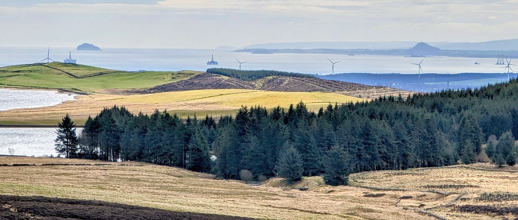
Linlithgow and the Firth of Forth from Cockleroy Hill in Beecraigs Country Park

Linlithgow and the Firth of Forth

 from Cockleroy Hill in Beecraigs Country Park

From the summit

there are excellent views over the Forth valley.

 On a clear day the view stretches

from Arran in the West to the Bass Rock in the East.

Other visible landmarks include:-

Ben Lomond, The Campsie Fells,

The Ochils, the Forth Bridges


Forth Bridges from Cockleroy Hill

Forth Road Bridge and Rail Bridge

from Cockleroy Hill


The Ochils and the Firth of Forth from Cockleroy Hill

The Ochils

and the Firth of Forth

from Cockleroy Hill


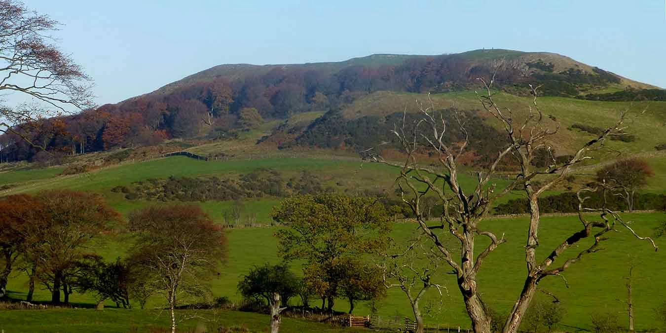
Cockleroy Hill above Linlithgow from the Loch

Cockleroy Hill above Linlithgow


Cockleroy Hill above Linlithgow from the Loch

Cockleroy Hill above Linlithgow


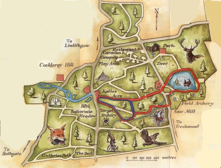
Plan of Beecraigs Country Park

Plan of Beecraigs Country Park 


Location map for Beecraigs Country Park

Location map for Beecraigs Country Park


Route Map of a cycle run around Beecraigs Country Park

Route Map of a cycle run

around Beecraigs Country Park


BEECRAIGS COUNTRY PARK - CYCLE RUN - ROUTE DESCRIPTION:

Location: West Lothian
Map: OS Landranger 65
Distance: 14 miles / 23km
Time: 2hours
Terrain: hilly, minor roads, short road section

Those unfamiliar with West Lothian may be surprised at the views and superb country cycling on this exerting ride. The route runs to the south of Linlithgow passing an important prehistoric site and gives extensive views across the central belt.
From Linlithgow train station go uphill passing under the railway to meet the Union Canal and bear right. Pass under a bridge and leave the towpath at the next road bridge to head south. Prepare for a lung-bursting climb before the gradient eases at a bend.
Cycle on, turning left at a sign for Beecraigs Country Park and right at the following fork for Cairnpapple Hill.
Further on take a sharp left by a brown Historic Scotland sign to reach the base of Cairnpapple Hill. which is topped by a 5000-year-old henge, once used for ceremonial purposes. The site reopens from April 1 but outwith the summer season one can still appreciate the large reconstructed cairn and seek up the atmosphere and views.
Continuing, the road dips and climbs to a look-out point. Follow the road as it bends right before a sharp
descent. At a T-junction turn left for a long descent to the A89. Turn left along this busy road ( path later ) and then left into Dechmont. At the village end turn left signed for Linlithgow.
This minor mad is well signed and makes for a rewarding return.


BEECRAIGS COUNTRY PARK - MOUNTAIN BIKING:

The forest trails around Beecraigs Country Park are a joyous spot for cycling, offering restorative tranquillity amid a cathedral of
towering Scots pine, Sitka spruce and conifers.
There is a choice of mountain bike routes: green ( easy ), blue ( moderate ) and red  (difficult ), as well as a dedicated skills area.
The surrounding Bathgate Hills — nicknamed the “Bathgate Alps” — are a popular haunt among cyclists seeking to challenge
themselves on the steep climbs.
The area’s many historical and natural landmarks include neolithic henge Cairnpapple ( a Historic Scotland site open April to September ),
as well as Cockleroy Hill, the former Hilderston Silver Mine and the distinctive crag-and-tail landform of The Knock.
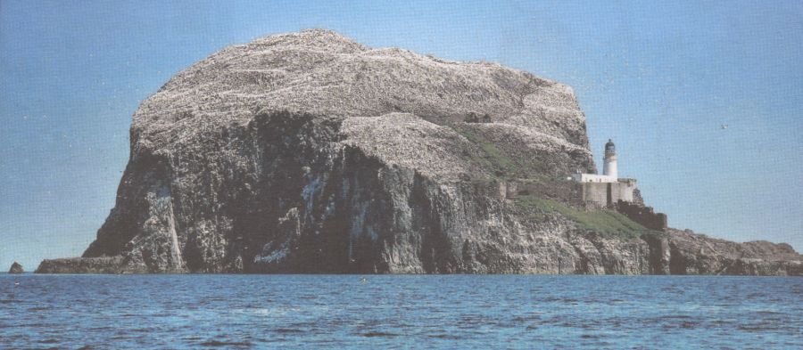


The Bass Rock in the Firth of Forth

The Bass Rock in the Firth of Forth

 is visible from Cockleroy Hill

The Bass ( 107m, 351ft high )

 is an uninhabited,

sheer-sided volcanic rock outcrop

that is home to a large colony of gannets.


The Bass Rock in the Firth of Forth

The Bass Rock in the Firth of Forth

 is visible from Cockleroy Hill


Lighthouse and gannets on The Bass Rock

Lighthouse and gannets

on The Bass Rock

 
 Beecraigs Gallery Photo Gallery

<< BackGlasgow Parks : Next >>


Scotland Index :: Scotland Walks

Glencoe | Ben Nevis | Knoydart | Isle of Skye | Isle of Arran | The West Highland Way

The Eastern Highlands | The Central Highlands | The Southern Highlands | The NW Highlands


Adventure Travel : Worldwide Mountaineering : Site Index

fb icon  google+ icon  Linkedin icon  twitter


Guide Books & Maps - Scotland:-


Western Scotland & the Western Isles OS Road Map Northern Scotland OS Road MapSouthern Scotland OS Road MapGlasgow Popular Hills - Map


Scotland - Lonely PlanetScotland's Highlands & Islands - Lonley Planet Scotland's Highlands & Islands - Rough Guide Highlands & Islands of Scotland - Hidden Places Rough Guide ScotlandScottish Highlands & Islands - Rough Guide Rough Guide: Scotland Lonely Planet, Walking in Scotland100 Hillwalks around Glasgow

Walking Through Scotland - From the Border to Cape Wrath Dumfries & Galloway - 25 Walks Scottish Borders - 25 WalksSt.Cuthbert's Way - Official Guide Southern Uplands WaySouthern Uplands WaySouthern Upland WayWalking the Southern Upland Way Across Scotland on Foot

Ochils and Campsie Fells  The Pentland Hills  The Border Country  Galloway Hills


Forth & Clyde Canal  Forth and Clyde Canal Exploring Edinburgh - Glasgow Canals 

Glasgow - A Portrait   Wee Book of Glasgow  Glasgow from the Air  Glasgow - No Mean City  Lost Glasgow  Glasgow - The Real Gorbals Story    

Glasgow Visitor Guide - Colin Baxter Itchy Insider's Guide to Glasgow Glasgow Footprint Pocket Guide Glasgow Insight Pocket Guide Glasgow Guide Pub Companion Glasgow Scotland's Highlands & Islands - Rough Guide Scotland - Rough Guide

Glasgow Insight Pocket GuideCollins Street Map of GlasgowGlasgow: Then & NowThey belonged to Glasgow Phillips Street Atlas of Glasgow & West Central Scotland Glasgow: The Photographic Atlas100 Hillwalks around Glasgow 50 Walks in Glasgow & SW Scotland

Visit Scotland - Touring Guide Scotland: Where to Stay - Hotels & Guest Houses Scotland: Where to Stay - Bed & Breakfast Rough Guide ScotlandScottish Highlands & Islands - Rough Guide Scotland - Lonely PlanetScotland's Highlands & Islands - Lonley Planet Great Glasgow StoriesGlasgow & Surroundings - Insight Guide

West Highland Way: Official GuideWest Highland Way: Rucksac ReadersWest Highland Way: TrailblazerThe West Highland WayWest Highland Way: Footprint MapWest Highland Way - Map West Highland Way - Map West Highland Way Wet Highland Way - Official Guide

Munro Almanac The High Mountains of Britain and Ireland The Munros: Scottish Mountaineering Club The Isle of Skye The Isle of Arran Wilderness Walks Ski Mountaineering in Scotland

More Wilderness Walks 50 Best Routes on Skye and Raasay Skye - W.A.PoucherMagic of the Munros Mountaineering in Scotland and Undiscovered Scotland by W.H.MurrayA Long Walk on the Isle of Skye

Classic Climbs - Central & Southern Highlands The Isle of Arran Lonely Planet, Walking in ScotlandPathfinder Guide: Skye and NW Highlands WalksPathfinder Guide: Fort William and Glen Coe Walks Rambler's Guide: Ben Nevis and Glen Coe50 Best Routes on Skye and Raasay - Chris Townsend


extremetracking


extremetracking

Google Analytics


Google Analytics

extremetracking
 eXTReMe Tracker


extremetracking
Sitelock caingram.com
SiteLock
Sitelock
Sitelock caingram.info
SiteLock
Sitelock