High Adventure: Accounts and photographs of walks, climbs and overland travels around the world

Worldwide Mountaineering :: Adventure Travel :: Site Index


Walking Scotland End to End:


Part 1: Scottish Borders to West Highland Way


Walking Through Scotland - From the Border to Cape Wrath Dumfries & Galloway - 25 WalksScottish Borders - 25 Walks St.Cuthbert's Way - Official Guide Southern Uplands WaySouthern Uplands WaySouthern Upland WayWalking the Southern Upland Way Across Scotland on Foot

Ochils and Campsie Fells  The Pentland Hills  The Border Country  Galloway Hills


Neidpath Castle in the Scottish Borders

Neidpath Castle in the Scottish Borders


Itinerary: Daily, place to place routes:-


Day 1) Kirk Yetholm to Jedburgh

From Kirk Yetholm follow the signs for St. Cuthbert's Way to the B6401 and on to Crookededshaws Hill. Continue through Morebattle and past Cessford Castle to Cessford Moor. Cross Oxnam Water and climb to Dere Street ( old Roman Road ). Follow signs for the Borders Abbeys Way into Jedburgh.

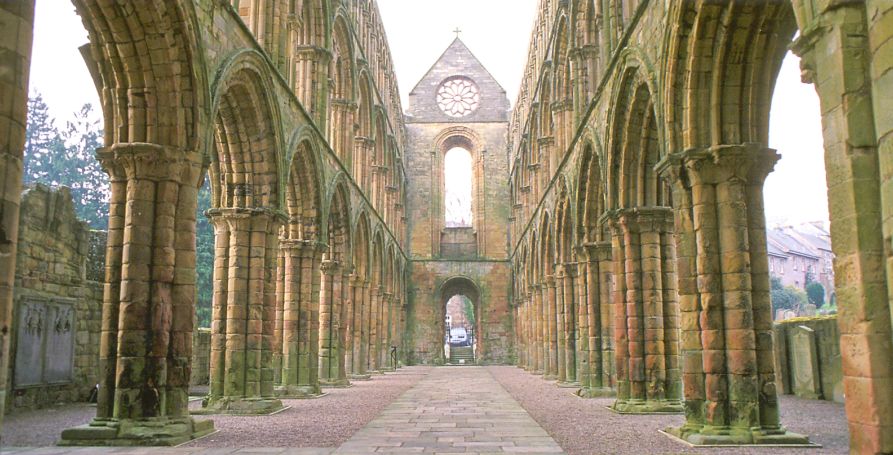
Jedburgh Abbey

Jedburgh Abbey

Jedburgh Abbey

Jedburgh Abbey


House of Mary Queen of Scots in Jedburgh

House of Mary Queen of Scots

in Jedburgh

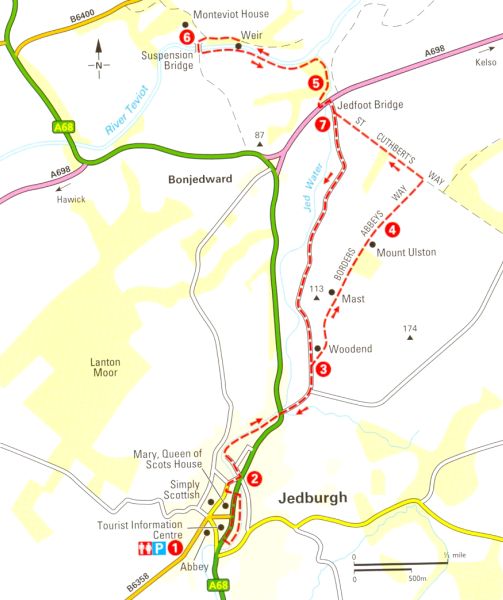
Map of Jedburgh

Map of Jedburgh


Day 2) Jedburgh to St.Boswells

Follow signs for the Borders Abbeys Way out of Jedburgh but stay on road to Jedfoot. Then follow the signs for St. Cuthbert's Way over A698, cross Monteviot footbridge and continue to Harestanes Visitor Centre. Return to St. Cuthbert's Way and follow signs to Dere Street. Continue along Dere Street then turn off into Maxton. Follow the signs for St. Cuthbert's Way alongside the River Tweed into St.Boswells.


Dere Street ( Old Roman Road ) at Maxton in the Scottish Borders_

Dere Street ( Old Roman Road )

at Maxton

Day 3) St.Boswells to Galashiels

Leave St.Boswells following the signs for St. Cuthbert's Way alongside the River Tweed and up The Glen to Newtown St.Boswells. Continue to Whitelee and the path to Bowden. Follow St. Cuthbert's Way through Bowden woods, over a saddle and down to Melrose. Go through Market Square to reach Melrose Abbey. Head down to the River Tweed to signs for The Southern Upland Way at the suspension bridge ( do not cross ) and continue along riverside path and then the old railway line into Galashiels.

Galashiels

Bank Street in Galashiels

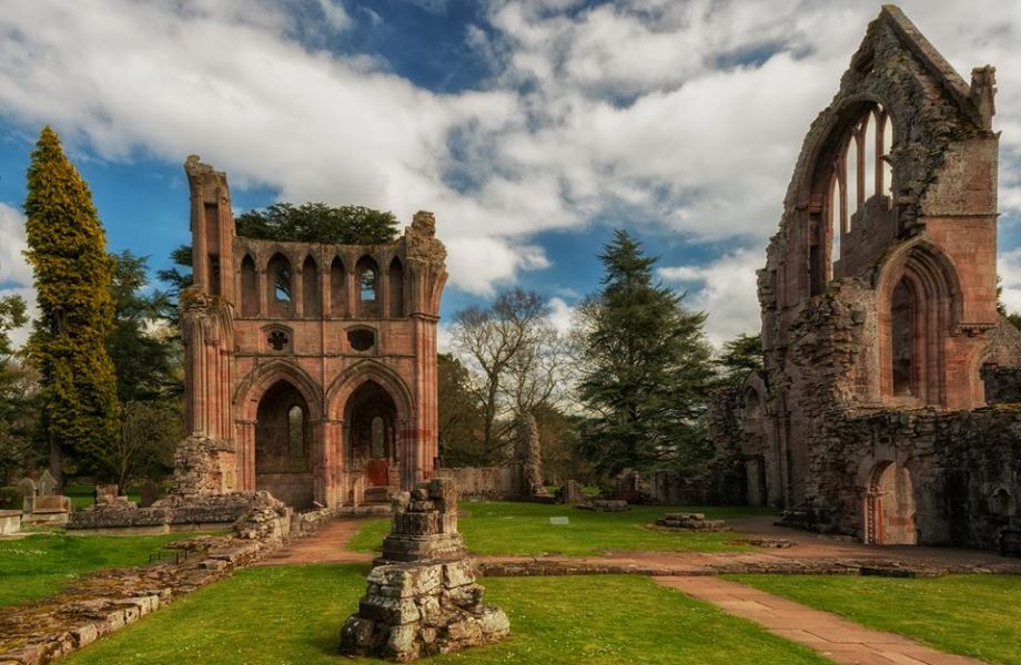
Dryburgh Abbey

Dryburgh Abbey

Day 4) Galashiels to Innerleithen

From Galashiels Swimming Pool follow the signs for The Southern Upland Way through Gala Policies to Yair Bridge. Continue following the signs through Yair Hill Forest and onto the Three Brethern. Take the Minch Muir track over Broomy Law and Brown Knowe then down through forest to Traquair. From Traquair cross the River Tweed and continue into Innerleithen.

Innerleithen

Innerleithen

Innerleithen  is where the River Leithen

 joins the 
River Tweed.

Day 5) Innerleithen to Peebles

Head west along Innerleithen High Street before turning north and climbing Lee Pen ( 502m ). Continue NW along the ridge over Black Knowe and Black Law ( 538m, trig point ). After Black Law head down through Glentress Forest past Cardie Hill to reach the A72. Cross over to reach path alongside the River Tweed and continue into Peebles.
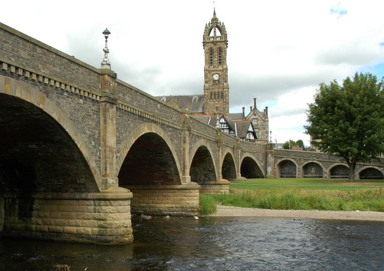
River Tweed in Peebles

River Tweed in Peebles

Day 6) Peebles to West Linton

Follow the signs for the John Buchan Way over the River Tweed bridge out of Peebles via Tantah and over Cademuir Hill. Continue on minor road round to The Glack and follow John Buchan Way over the hill to Stobo and on to Stobo Hopehead. Turn right at junction west of Stobo Hopehead and walk to top of Ladyurd Forest. Go left on entering forest and follow road down to the A72. Turn right at the turning circle then left past Grantshall to take path to Blyth Bridge. Follow the Tweed Trails signs across fields and by the Tarth Water. Turn right on the A702 and first left onto Blyth Farm Road. After the farm fork right and follow Tweed Trails signs to a track and then a road into West Linton.


Aerial view of West Linton in the Scottish Borders

Aerial view of West Linton


Day 7) West Linton to Broxburn

Take the minor road out of West Linton towards Baddinsgill Farm. Follow the signposted path over Cauldstane Slap pass and down to the A70. Turn right and walk along A70 for about 1km and turn left into Leyden Road. Continue to the end of the road. Turn left on to National Cycle Route 75 and follow it across the A71 and on into Almondell Country Park. Walk through park over Naismith's Bridge and past the Visitor Centre to the park exit. Head north on the minor road to reach the Union Canal. Turn left and follow the canal northwards ro reach Broxburn.

Greendykes Road in Broxburn in Central Scotland

Greendykes Road in Broxburn

Day 8) Broxburn to Linlithgow

From Broxburn to Linlithgow the route follows the walkway alongide the Union Canal.

Linlithgow Town from the Palace

Linlithgow Town from the Palace

Day 9) Linlithgow to FalkirkThe Falkirk Wheel )

From Linlithgow to Falkirk the route follows the walkway alongide the Union Canal.

The Falkirk Wheel

The Falkirk Wheel

Day 10) Falkirk to Kilsyth

From Falkirk to Kilsyth the route follows the walkway alongside the Forth & Clyde Canal 

This parallels the Antonine Wall which may be viewed at several locations.

Kilsyth

Kilsyth

Day 11) Kilsyth to Glasgow ( Maryhill Locks )

From Kilsyth the route continues to follow the walkway alongside the Forth & Clyde Canal

Day 12) Maryhill Locks to Milngavie 

The route follows the Kelvin River Walkway to the start of the West Highland Way in Milngavie.

References:-


Climbing & Outdoors Gear:-


Scotland End to End :: West Highland Way :: Southern Upland Way


Scotland Index :: Scottish Peaks ::Scotland Walks

Southern Highlands :: Central Highlands :: NW Highlands :: Eastern Highlands

Skye :: Arran :: Glencoe :: Ben Nevis :: Knoydart


Site IndexWorldwide MountaineeringAdventure Travel


fb icon  google+ icon Linkedin icon  twitter


Maps of Scotland:-


Western Scotland & the Western Isles OS Road Map Northern Scotland OS Road MapSouthern Scotland OS Road Map Torridon Map Kintail, Glen Shiel - Map Arrochar Alps - Map Glasgow Popular Hills - Map Ben Nevis Map West Highland Way - Map

Glen Shiel & Loch Hourn - OS Landranger Map An Teallach & Slioch - OS Explorer Map Creag Meagaidh & Loch Laggan - OS Explorer Map Gairloch, Ullapool & Loch Maree OS Map Ben Nevis & Glencoe OS Landranger Map The Munros Map


Travel & Guide Books- Scotland:-


  Southern Upland Way  Dumfries & Galloway - 25 Walks Scottish Borders - 25 WalksSt.Cuthbert's Way - Official Guide Southern Uplands Way Southern Uplands WayAcross Scotland on FootWalking Through Scotland - From the Border to Cape Wrath North to the Cape - Fort William to Cape Wrath

Ochils and Campsie Fells  The Pentland Hills  The Border Country  Galloway Hills

West Highland Way: Official GuideWest Highland Way: Rucksac ReadersWest Highland Way: TrailblazerThe West Highland WayWest Highland Way: Footprint MapWest Highland Way - Map West Highland Way - Map West Highland Way Wet Highland Way - Official Guide

Scotland - Lonely PlanetScotland's Highlands & Islands - Lonley Planet Scotland's Highlands & Islands - Rough Guide Highlands & Islands of Scotland - Hidden Places Rough Guide ScotlandScottish Highlands & Islands - Rough Guide Rough Guide: Scotland Lonely Planet, Walking in Scotland100 Hillwalks around Glasgow

50 Walks in Glasgow & SW Scotland 50 Walks in the Scottish Highlands & Islands 50 Walks in Edinburgh & Eastern Scotland 100 Walks in ScotlandVisit Scotland - Touring Guide Scotland: Where to Stay - Hotels & Guest Houses Scotland: Where to Stay - Bed & Breakfast Hillwalker: The MunrosHillwalker: The Corbetts

The Munros: Scottish Mountaineering Club The Munros and Tops The Corbetts - SMC Call of the Corbetts Munros & Corbetts Chart The High Mountains of Britain and Ireland Magic of the Munros The Munros - Scotland's highest mountains

Munro Almanac The Munros: Scottish Mountaineering Club Hamish's Mountain WalkThe Munros in WinterMy Scotland by Hamish MacInnes 50 More Routes on Scottish Mountains Scottish Mountains - 50 Classic Routes

The High Mountains of Britain and Ireland Scotlands 100 Best Walks Scottish Mountains - 100 Best RoutesBig Walks of Great Britain Classic Walks in Britain & IrelandScottish Hill & Mountain NamesClassic Mountain Scrambles in Scotland Classic Climbs - Central & Southern Highlands

 Scotland's Far North

Mountaineering in Scotland and Undiscovered Scotland by W.H.MurrayMore Wilderness Walks Wilderness Walks Wilderness Walks 2 - Video Pathfinder Guide: Skye and NW Highlands WalksPathfinder Guide: Fort William and Glen Coe Walks Rambler's Guide: Ben Nevis and Glen Coe

Torridon: A Walkers Guide Scottish Hill Tracks100 Best Routes on Scottish Mountains Landscapes of the Scottish Highlands & the Isle of Skye The Glens of Rannoch Glens of Trossach Scottish Glens: The Atholl GlensNorth to the Cape - Fort William to Cape Wrath

  Southern Highlands - MapNorthern Highlands Central Highlands West Highlands The Islands Central Highlands SMC NW Highlands SMC Central Highlands: Six Long Distance Walks Exploring Scottish Hill Tracks

Mountain Days & Bothy Nights Northern Highlands, Volume 1 - SMC Northern Highlands, Volume 2 - SMC Winter Climbs: Ben Nevis and Glencoe Loch Lomond & Trossachs WalksThe Grahams - Scotland's 2000ft Peaks The Book of the BivvyMountain Travellers Handbook

Geology & Landscapes of Scotland The Highland Geology Trail Weather for Hillwakers & Climbers Mountain Weather Guide to the Weather Weather: Collins Gem Hillwalking Handbook for Mountain Leaders Hillwalkers Manual Hillwalkers Guide to Mountaineering

First Aid on MountainsWalking the Munros Vol 2: Northern Highlands & CairngormsWalking the Munros Vol 1: Southern, Central & Western HighlandsScotland Travel Guide Lonely Planet Walking Through Scotland - From the Border to Cape Wrath Discovering Scotland - Atlas & Guide Britain's Best WalksBest Routes on Britain's Mountains

200 Challenging Walks in Britain & Ireland Scotland - The Wild Places - Colin Prior The Munro Show 1 & 2 - Muriel GrayFrontiers: The World's Best Hikes Great British Ridge Walks Torridon - Life & Wildlife in the Scottish Highlands

GPS for Dummies Wilderness NavigationNavigation for Walkers


Keep right on to the end of the road


Keep right on to the end of the road

Google Analytics


Google Analytics

extremetracking
 eXTReMe Tracker


extremetracking
Sitelock caingram.com
SiteLock
Sitelock
Sitelock caingram.info
SiteLock
Sitelock