  |
The Scottish HighlandsStuchd an Lochain
|
  |
Photographs of a traverse of the Munro Stuchd an Lochain
above Glen Lyon and Loch an Daimh
in the Central Highlands of Scotland
Creag
an Tulabhain
above dam on Stronuich Reservoir in Glen Lyon |
|
Lodge
at Cashlie
in Glen Lyon |
|
An
Grianan ( 2835ft, 864m )
above Glen Lyon |
|
Meall
Ghaordie ( Ghaordaidh )
- 3409ft, 1039m - above Stronuich Reservoir in Glen Lyon |
|
|
|
Stuchd an Lochain ( 960m,
3150ft )
from An Grianan |
|
Summit cone
of Stuchd an Lochain ( 960m, 3150ft ) |
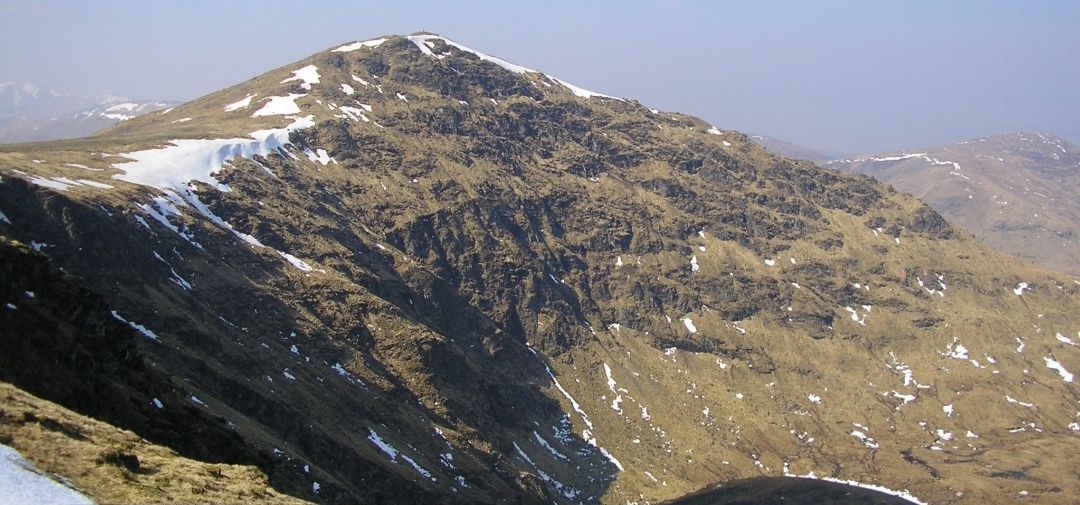 Summit cone
of Stuchd an Lochain ( 960m, 3150ft ) |
|
Corbett
Sron a'Choire Chnapanich ( 837m, 2746ft )
above Loch an Daimh from summit of Stuchd an Lochain |
|
Meall Buidhe (
932m, 3058ft )
above Loch an Daimh from summit of Stuchd an Lochain |
|
Stuchd an Lochain
above Lochan nan Cat |
|
|
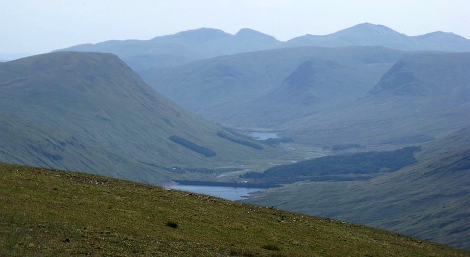 Glen
Lyon
and Lawyers Group |
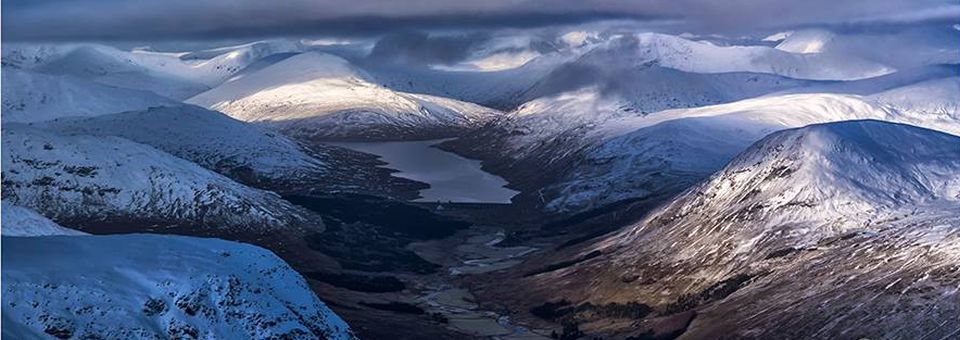 Loch
Lyon
|
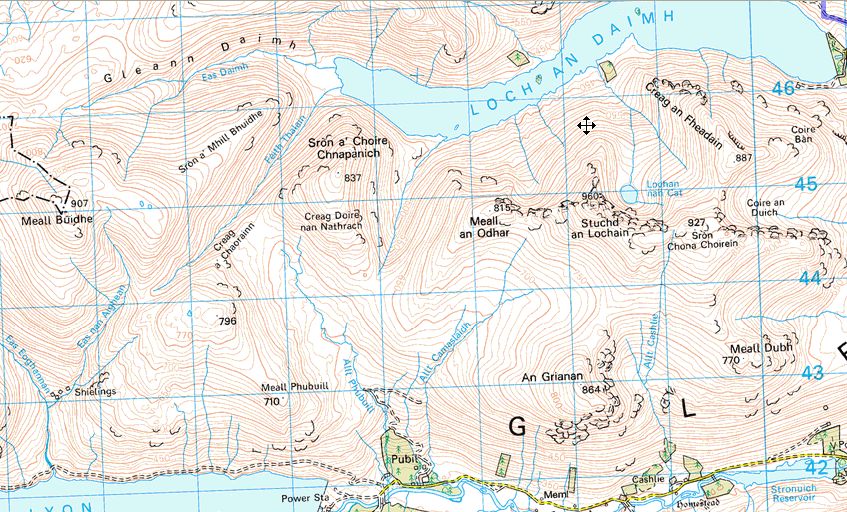 Map of
Stuchd an Lochain
|
 Route
Map
for Stuchd an Lochain |
STUCHD an LOCHAIN - ROUTE DESCRIPTION:
Location|: Glen Lyon
Map: OS Landranger 51
Distance: 6 miles ( 10km )
Time: 3.5-4.5 hours
Terrain: hilIwalk
Close to the head of Glen Lyon in Perthshire a side road crosses pine-studded moorland to a concrete dam that holds back the waters of Loch An Daimh.
On either side of the dam two big hills rise up - Stuchd An Lochain ( 3150ft, 961m ) and Meall Buidhe (3058ft, 931m).
Most munro-baggers climb the former, return to their starting point by the dam, climb Meall Buidhe and return by the same route.
It’s perhaps only when you've climbed all 284 munros that you can afford the luxury of visiting the hills as individuals, having time to explore them fully.
These hills can also be climbed as part of a circuit of Loch An Daimh, starting and finishing at the dam.
The head of Loch An Daimh is a wonderful spot, remote and atmospheric.
This makes a superb circular walk and adds an extra corbett, Sron A‘ Choire Chnapenich ( 2746ft, 837m ), as a bonus.
Stuchd An Lochaln can also be climbed from Cashlie at the western end of the Stronuich Reservoir via the Allt Cashlie, which leads to the plateau between Sron
Chona Choirein and the summit, but this route of ascent lacks the character of the north side.
Better to start from the Loch An Daimh dam, or more correctly, the Giorra Dam.
There were once two lochs here, Loch Giorra and Loch An Daimh, separated by a strip of land where there was a
farmhouse and a tract of woodland. These were submerged below the waters when the dam was built and the waters raised.
The Hydro Board has chosen to keep the name Giorra for the name of the dam, although the OS prefers Loch An Daimh.
From the south end of the dam a faint path climbs grassy slopes south to reach the ridge above Coire Bah.
A line of fence posts can be followed west to Creag An Fheadaia from where a descent into a bealach is followed by an easy climb to Sron Choma Choirein.
A broad mossy ridge leads round the cliffs above Lochan Nah Cat to the summit where, in 1590, a laird called Mad Colin Campbell of Meggernie took
a perverse delight in chasing a herd of goats over the edge into the lochan below.
But Campbell really earned his nickname as a madman when he tried to throw the shepherd over the edge as well.
If you get as good a day you'll enjoy a 360 degree panorama giving views of hills ranging from the Cairngorns to Ben Nevis, and
Buachaille Etive Mor to Ben Lawers.
This summit has to be one of the finest viewpoints in the southern Highlands.
Route:
From the south side of the dam follow at track for a short distance to where a cairned route leaves the track and climbs the slopes of Coire Ban.
Continue climbing this eroded path to reach the ridge above the coire.
Follow the ridge and old fence posts to Creag an Fheadain then SSW to Sron Chona Choirein then W and NW to the summit slopes of Stuchd a n Lochain.
Return the same way.
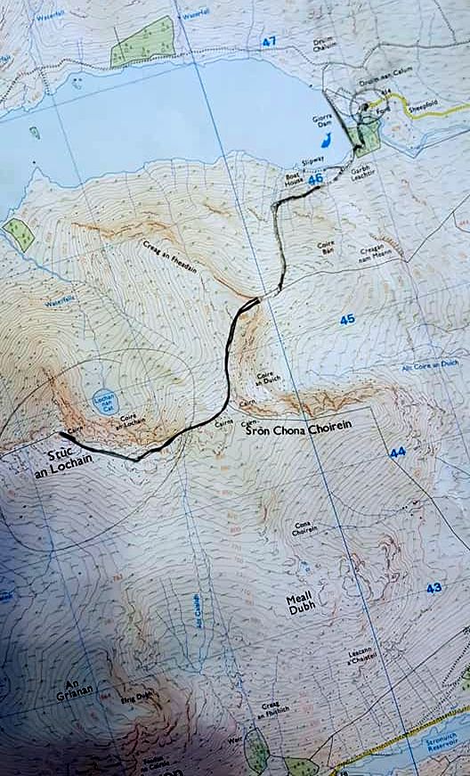 Map
for
Stuchd an Lochain
|
Ben Nevis | Knoydart | Isle of Skye | Isle of Arran | The West Highland Way
The Eastern Highlands | The Central Highlands | The Southern Highlands | The NW Highlands