Munros Tables SMC Scottish Highlands Hillwalking Guide

 The Scottish Highlands


Schiehallion
The High Mountains of Britain & Ireland Southern Highlands - Map


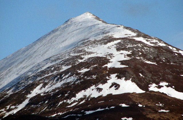
Schiehallion - NW Ridge

NW Ridge of Schiehallion


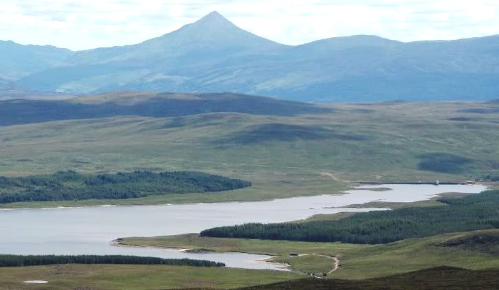
Schiehallion from Farragon Hill

Schiehallion from Farragon Hill


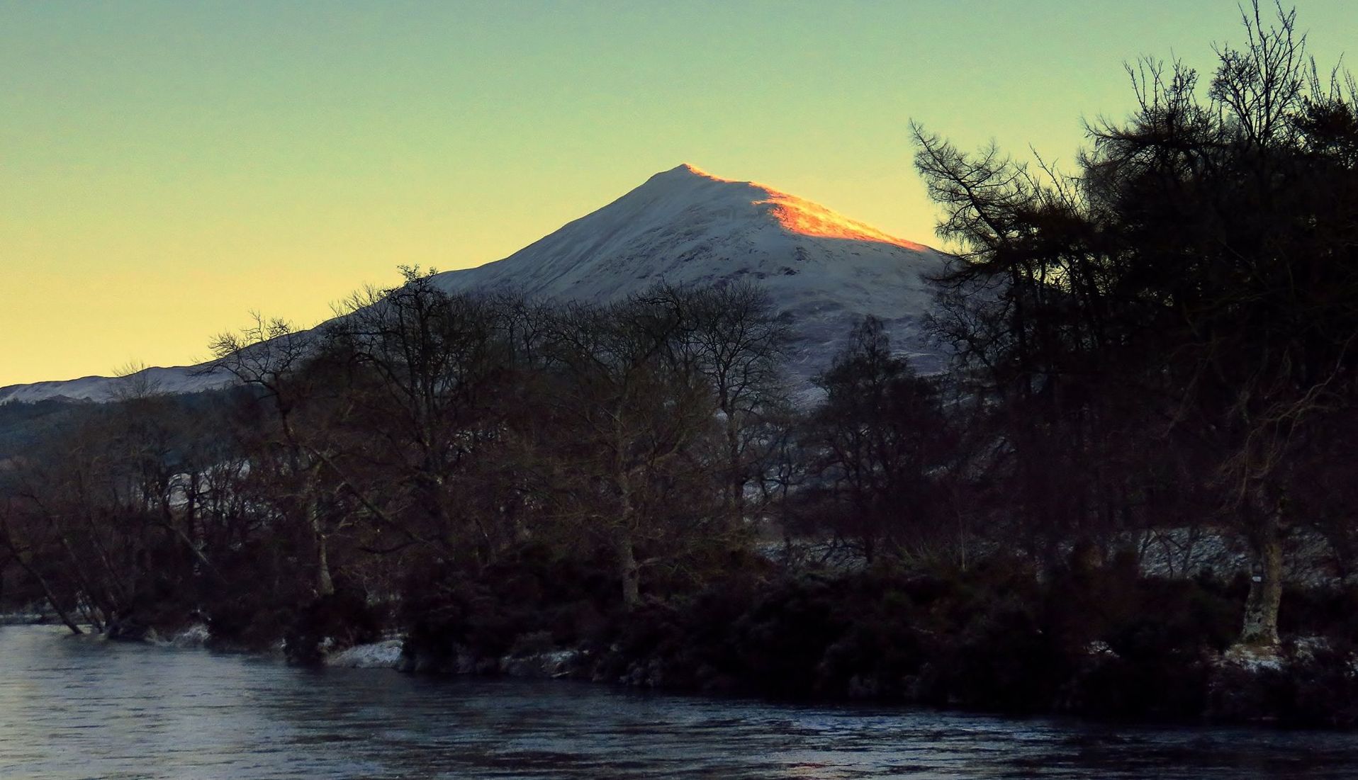
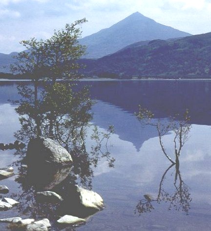
Schiehallion from across River Tay

Schiehallion ( 3547ft, 1083m )

Schiehallion lies between Loch Tay

and Loch Tummel

some 10 miles north of Aberfeldy.

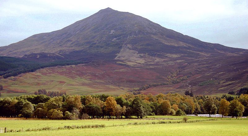
The mountain is an isolated one

and has an almost perfectly conical shape

as viewed from the west. 

Schiehallion is sometimes described

 as the centre of Scotland.


Schiehallion from across River Tay

Schiehallion


Schiehallion from starting point of ascent at Braes of Foss

Schiehallion from starting point

 for ascent at Braes of Foss
.


Schiehallion above Loch Rannoch on ascent of Beinn a' Chuallaich

Schiehallion above Loch Rannoch

on ascent of Beinn a' Chuallaich


Beinn a' Chuallaich from Schiehallion

Beinn a' Chuallaich

from Schiehallion


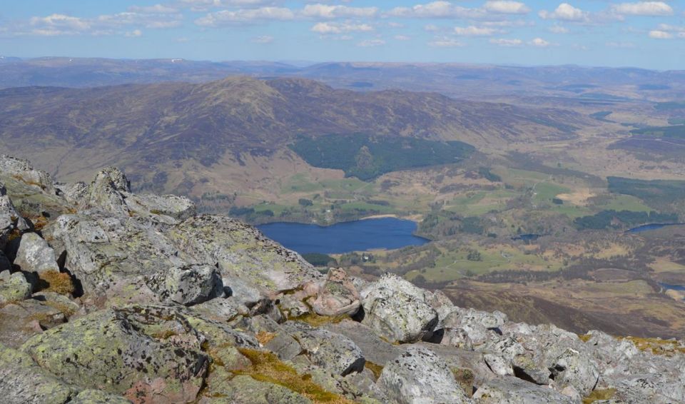
View from Schiehallion

View from Schiehallion


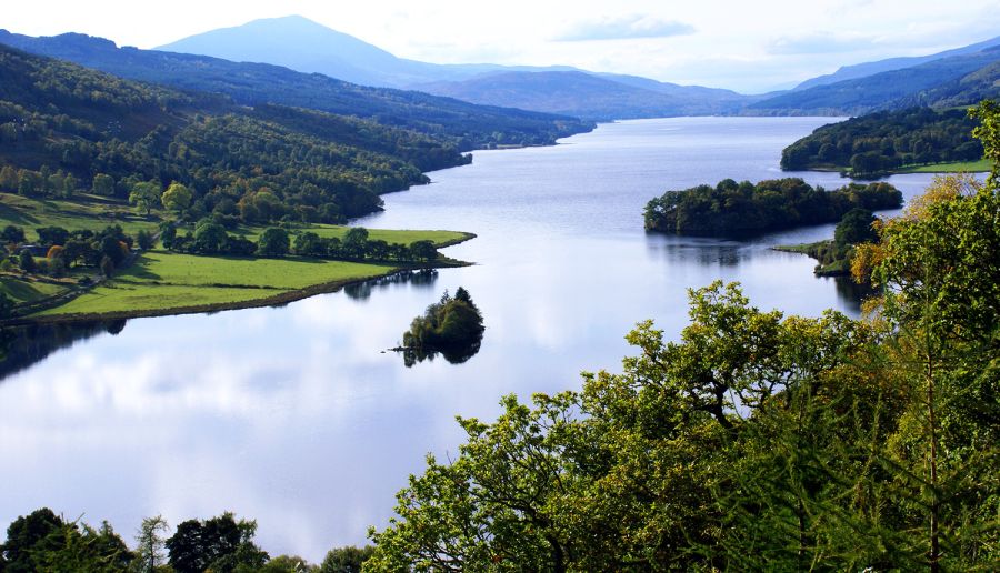
Queen's View - Loch Tummel and Schiehallion

Queen's View

- Loch Tummel and Schiehallion

The Queen's View attracts many visitors

to the shores of Loch Tummel.


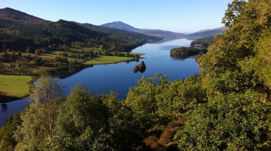
Queen's View - Loch Tummel and Schiehallion

Queen's View

- Loch Tummel and Schiehallion


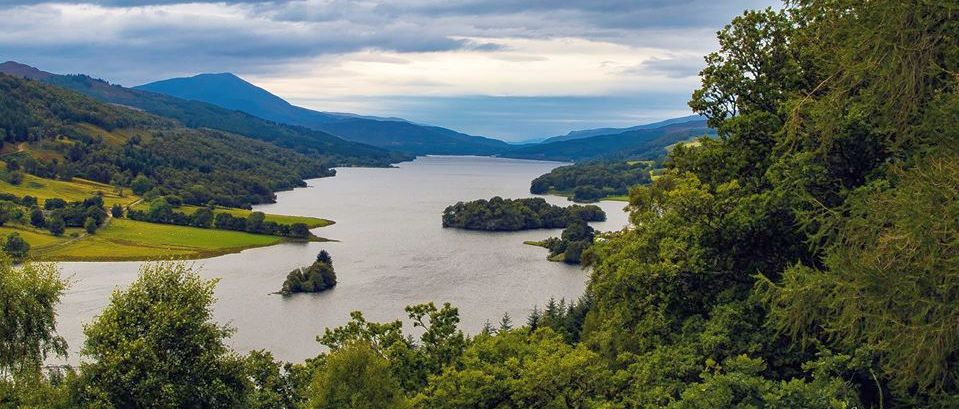
Queen's View - Loch Tummel and Schiehallion

Queen's View

- Loch Tummel and Schiehallion


Queen's View - Loch Tummel and Schiehallion

Queen's View

- Loch Tummel and Schiehallion


Loch Tummel and Schiehallion

Loch Tummel

and Schiehallion


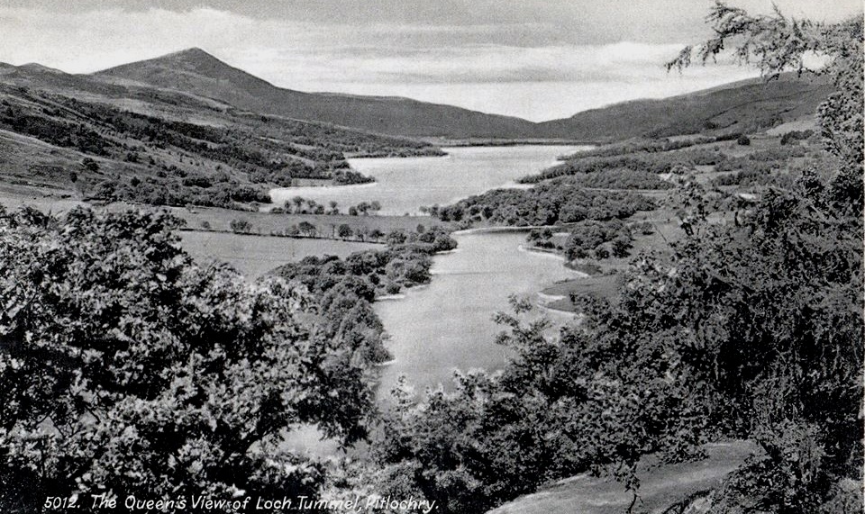
Queen's View - Loch Tummel and Schiehallion - old postcard

Queen's View

- Loch Tummel and Schiehallion

- old postcard


Loch Ericht and Schiehallion

Loch Ericht

and Schiehallion


Loch Tummel and Schiehallion

Loch Tummel

and Schiehallion


Schiehallion from Loch Rannoch

Loch Rannoch and Schiehallion


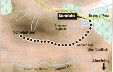
Map and access route for Schiehallion

Map and access route for Schiehallion


Route Map for Schiehallion

Route Map for Schiehallion


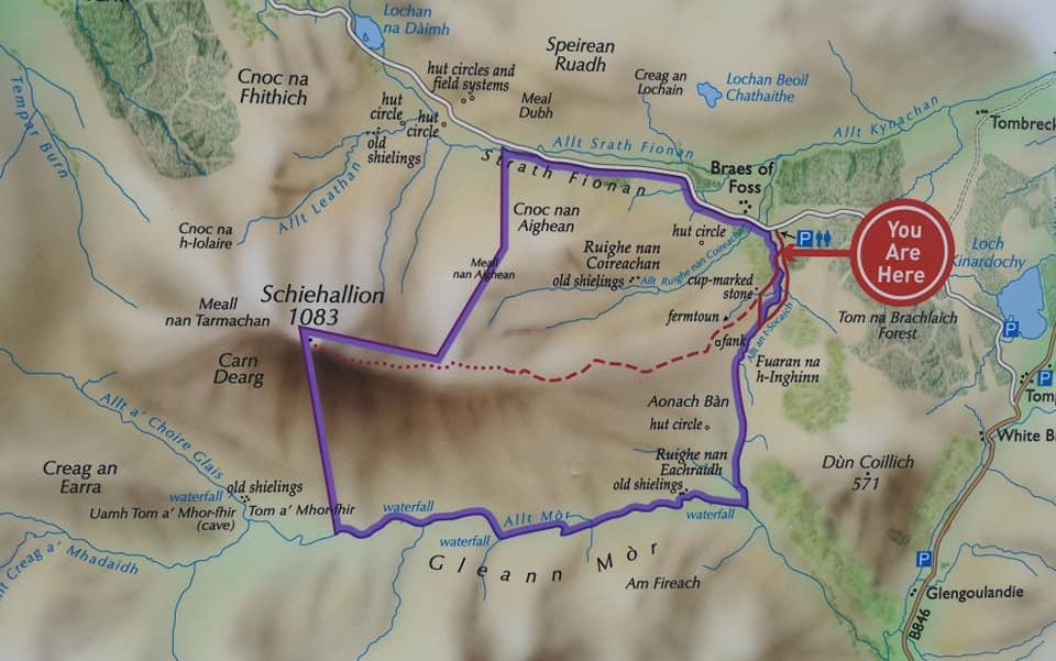
Map and access route for Schiehallion

Map and access route for Schiehallion


SCHIEHALLION - ROUTE DESCRIPTION:

Location: Perthshire
Map: OS Landranger 51 or 52 ( GR 753 557 )
Distance: 6 miles [10km]
Time: 4 hours
Terrain: path

Schiehallion is an elegant mountain that sits detached from its neighbours in lovely countryside between the great Loch Tay valley in the south and the Loch Rannoch and Loch Tummel valley to the north. Its ascent is best started from the Forestry Commission Scotland pay-and-display car park and toilets at Braes of Foss, on the narrow road between Aberfeldy and Kinloch Rannoch.
At the entrance to the car park a plaque commemorates the fact that in 1774 the Astronomer Royal, Neil Maskelyne, used Schiehallion to illustrate the gravitational force of mountains and to calculate the density of the Earth.
The car  park sits at an altilude of a little more than 300m, which means you don't climb the mountains full 1083m height.
This, together with Schiehallion's accessibility and the fact there is an excellent path up the east ridge, means its ascent is relatively straightforward. It is therefore a mountain that many can claim as their first Munro.
As with all peaks though, it shouldn't be underestimated, especially when the vagaries of the Scottish weather are taken into account.
The east side of the mountain is owned by the John Muir Trust and, an leaving the car park, there is information to this effect.
In recenl years the Trust has built a footpath on a slightly different and more sustainable line to enable the scar created on the hillside by the formcr route to regenerate. The new path is excellent and, while it may feel a bit over-engineered to some, it does allow for the easy passage of the large numbers who ascend this iconic hill.
There is no waymarking on the path and it stops short of the summit on stony ground which is followed past a number of old cairns to the final highpoint and the splendid panorma it offers.
Return by the route of asccnt.


Map and access route description for Schiehallion

Map and access route description for Schiehallion


Map and access route description for Schiehallion

Map and access route description for Schiehallion


Schiehallion Gallery Photo Gallery

<< BackSouthern Highlands : Next >>


Scotland Index :: Scottish Peaks :: Scotland Walks

Isle of Skye :: Isle of Arran

Knoydart :: Glencoe :: Ben Nevis :: NW Highlands :: Eastern Highlands :: Central Highlands


Worldwide Mountaineering :: Adventure Travel :: Site Index

fb icon  google+ icon Linkedin icon  twitter


Travel & Guide Books & Maps - Scotland:-


Western Scotland & the Western Isles OS Road Map Northern Scotland OS Road MapSouthern Scotland OS Road Map Gairloch, Ullapool & Loch Maree OS Map Aviemore, Granton & Cairngorm Mountains OS Map Iona & Mull MapIsle of Arran OS Explorer MapIsle of Arran OS Landranger Map Arran - Official Tourist Map

Torridon Map Kintail, Glen Shiel - Map Cairngorm - Map Arrochar Alps - Map Glasgow Popular Hills - Map Lochnagar & Glenshee - Map Skye, Storr & Trotternish - MapSkye - THe Cuillin The Munros Map Ben Nevis Map West Highland Way - Map Ben Nevis & Glencoe OS Landranger Map

North Skye: Dunvegan & Portree - OS Landranger Mao Skye: Dunvegan - OS Explorer Map Skye: Trotternish & the Storr - OS Explorer Map Skye: Portree & Bracadale - OS Explorer Map Glen Shiel & Loch Hourn - OS Landranger Map An Teallach & Slioch - OS Explorer Map Creag Meagaidh & Loch Laggan - OS Explorer Map Braemar, Tomintoul & Glen Avon - OS Explorer Map Kingussie & Monadhliath Mountains


Loch Lomond & Trossachs - 25 Walks  Loch Lomond & Trossachs NP - Vol 1 - West  Loch Lomond & Trossachs NP - Vol 2 - East

Lonely Planet - Scotland  Scottish Highlands & Islands - Rough Guide  Scotland - Rough Guide   Magic of the Munros  Scottish Mountains  Scotland's Mountains

The High Mountains of Britain & Ireland  Munros Tables SMC  The Munros - Scotland's Highest Mountains  Scotland - Lonely Planet  NW Highlands - SMC Guide  Exploring the Far NW of Scotland  Guide to Walks in NW Highlands

Walking in Scotland - Lonely Planet Mountain: Exploring Britain's High Places  National 3 Peaks Walk Scottish Highlands Hillwalking Guide The Scottish Islands Bouldering in Scotland

Scotland - Lonely PlanetScotland's Highlands & Islands - Lonley Planet Scotland's Highlands & Islands - Rough Guide Highlands & Islands of Scotland - Hidden Places Rough Guide ScotlandScottish Highlands & Islands - Rough Guide Rough Guide: Scotland Lonely Planet, Walking in ScotlandLonely Planet - Walking in Britain

50 Walks in Glasgow & SW Scotland 50 Walks in the Scottish Highlands & Islands 50 Walks in Edinburgh & Eastern Scotland 100 Walks in ScotlandVisit Scotland - Touring Guide Scotland: Where to Stay - Hotels & Guest Houses Scotland: Where to Stay - Bed & Breakfast Hillwalker: The MunrosHillwalker: The Corbetts

The Munros: Scottish Mountaineering Club The Munros and Tops The Corbetts - SMC Call of the Corbetts Munros & Corbetts Chart The High Mountains of Britain and Ireland Magic of the Munros The Munros - Scotland's highest mountains

Munro Almanac The Munros: Scottish Mountaineering Club Hamish's Mountain WalkThe Munros in WinterMy Scotland by Hamish MacInnes 50 More Routes on Scottish Mountains Scottish Mountains - 50 Classic Routes

The High Mountains of Britain and Ireland Scotlands 100 Best Walks Scottish Mountains - 100 Best RoutesBig Walks of Great Britain Classic Walks in Britain & IrelandScottish Hill & Mountain Names Classic Mountain Scrambles in Scotland Classic Climbs - Central & Southern Highlands 

Mountaineering in Scotland and Undiscovered Scotland by W.H.MurrayMore Wilderness Walks Wilderness Walks Wilderness Walks 2 - Video Ski Mountaineering in Scotland Ski Touring in ScotlandSkye Scrambles The Cuillin

Skye - W.A.PoucherA Long Walk on the Isle of Skye 50 Best Routes on Skye and Raasay Scrambles in Skye The CuillinsThe Isle of Skye

50 Best Routes on Skye and Raasay - Chris Townsend Pathfinder Guide: Skye and NW Highlands WalksPathfinder Guide: Fort William and Glen Coe Walks Rambler's Guide: Ben Nevis and Glen CoeGlencoe Rock & Ice Climbing Scrambles in Lochaber Rock Climbing in ScotlandRock Climbing Skills The FACE: Six Great Climbing Adventures Ben Nevis: Rock & Ice Climbs

Great Snow & Ice Climbs of the British IslesTorridon: A Walkers Guide Scottish Hill Tracks100 Best Routes on Scottish Mountains From the Himalaya to Skye One Man's Mountains - Tom Patey A Mountaineer's Tale - W.H.MurrayDougal Haston: Philosophy of RiskLandscapes of the Scottish Highlands & the Isle of Skye

The Glens of Rannoch Cairngorm Glens Glens of Trossach Knoydart to Morven Scottish Glens: The Atholl GlensThe Isle of Arran The Isle of Arran Walking in the Hebrides North to the Cape - Fort William to Cape Wrath

  Southern Highlands - MapNorthern Highlands Central Highlands West Highlands The Islands Central Highlands SMC NW Highlands SMC Central Highlands: Six Long Distance Walks Exploring Scottish Hill Tracks

The Cairngorms Cairngorms, Lochnagar, Mounth - SMC Walks in the Cairngorms The Cairngorms of Scotland Cairngorms Walks Winter Climbs in the CaingormsThe Cairngorms - Cicerone GuideCairngorms - Mountain Bike Guide101 Mountain Bike Routes in Scotland

Northern Highlands, Volume 1 - SMC Northern Highlands, Volume 2 - SMC The Cairngorms Vol. 1 - SMC The Cairngorms Vol. 2 - SMC NE Outcrops - SMC Highland Outcrops Scottish Winter ClimbsBen Nevis Rock & Ice Climbs Winter Climbs: Ben Nevis and Glencoe

West Highland Way: Official GuideWest Highland Way: Rucksac Readers West Highland Way: TrailblazerThe West Highland WayWest Highland Way: Footprint MapWest Highland Way - Map West Highland Way - Map 100 Hillwalks around GlasgowWest Highland Way Wet Highland Way - Official Guide

Oban, Mull & Kintyre - OS Pathfinder Guide Loch Lomond & Trossachs Walks Mull & Iona - Pevensey GuideIsle of Bute - Pevensey Guide The Grahams - Scotland's 2000ft Peaks The Book of the BivvySkye 360 - Walking the Coastline Isle of Skye - A Walkers GuideSkye - Pevensey Island Guide

Geology & Landscapes of Scotland The Highland Geology Trail Weather for Hillwakers & Climbers Mountain Weather Guide to the Weather Weather: Collins Gem Hillwalking Handbook for Mountain Leaders Hillwalkers Manual Hillwalkers Guide to Mountaineering

All Mountain Skier Off Piste Mountain Travellers HandbookMountaineering: Freedom of the Hills Mountaineering: The Freedom of the HillsHistory of Mountain ClimbingWorld's most significant ClimbsClimbing Free: My Life in the Vertical World

Mountain Leadership Handbook of Climbing - Hamish MacInnesRope Techniques: The complete guideMountain Skills Training Handbook First Aid on Mountains Mountains of the Mind - A history..Mountains of the Mind - ExperiencesWalking the Munros Vol 2: Northern Highlands & Cairngorms

Scotland's Far North  Walking the Munros Vol 1: Southern, Central & Western Highlands

Skye & the Western Isles Scotland Travel Guide Lonely Planet Walking Through Scotland - From the Border to Cape Wrath Discovering Scotland - Atlas & Guide Autumn Road to the IslesBritain's Best WalksBest Routes on Britain's Mountains The Joy of Climbing

200 Challenging Walks in Britain & Ireland Scotland - The Wild Places - Colin Prior Frontiers: The World's Best Hikes Great British Ridge Walks Torridon - Life & Wildlife in the Scottish Highlands Scottish Mountains - 50 Classic Routes Mountain Days & Bothy Nights

GPS for Dummies Wilderness NavigationNavigation for WalkersInstant Weather Forecasting Weather Wizards Cloud BookThe Munro Show 1 & 2 - Muriel Gray


Scotland the Brave / We're No Awa / Black Bear


Scottish Band Music

extremetracking
 eXTReMe Tracker


extremetracking
Sitelock caingram.com
SiteLock
Sitelock
Sitelock caingram.info
SiteLock
Sitelock