Munros Tables SMC The Corbetts - SMC

 The Scottish Highlands

Beinn Ime
The High Mountains of Britain & Ireland Arrochar Alps - Map

 Photographs of an ascent of the Munro Beinn Ime

and surrounding peaks in the Arrochar Alps

Beinn LuibheanBeinn NarnainBinnein an Fhidhleir,

Ben DonichBen Arthur ( Cobbler )

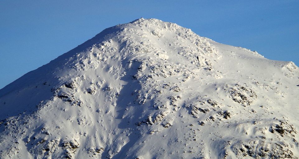
Beinn Ime from Beinn Luibhean

Beinn Ime ( 3318ft - a Munro )

from Beinn Luibhean ( 2815ft, 858m - a Corbett )


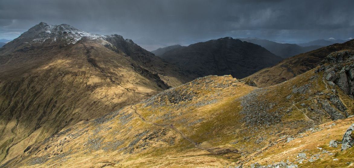
Beinn Ime and Beinn Luibhean from Beinn an Lochain

Beinn Ime and Beinn Luibhean

from Beinn an Lochain


Beinn Ime from Beinn an Lochain

Beinn Ime

from Beinn an Lochain


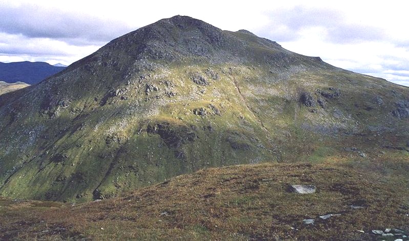
Beinn Ime from Beinn Narnain

Beinn Ime ( 3318ft )

from Beinn Narnain


Beinn Ime from Beinn Narnain

Beinn Ime ( 3318ft )

from Beinn Narnain


Beinn Ime from Ben Vane

Beinn Ime

from Ben Vane


Ben Lomond and Beinn Narnain from Beinn Ime

Ben Lomond and Beinn Narnain

from Beinn Ime


Loch Lomond, Loch Arklet and Loch Katrine from Beinn Ime


Ben Vane and Ben Vorlich from Beinn Narnain

Ben Vorlich and Ben Vane

from Beinn Ime


The Arrocher Alps - Beinn Ime

Beinn Ime

from Beinn Chorranach


Beinn Ime

Beinn Ime


The Arrocher Alps - Beinn Chorranach and Beinn Ime from Glen Kinglas

Beinn Chorranach and Beinn Ime from Glen Kinglas

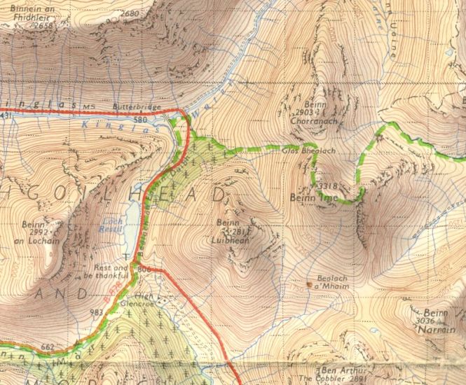
Showing the usual route of ascent for Beinn Ime via the Bealach a'Mhaim


Beinn Charronach and Beinn Ime from the A83 through Glen Kinglas

Beinn Chorranach and Beinn Ime

from the A83 through Glen Kinglas


The Arrocher Alps from Binnein an Fhidhleir


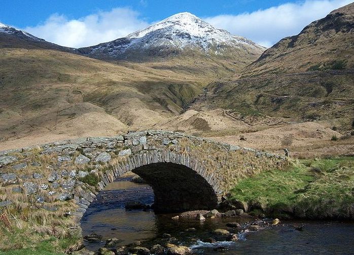
Ben Ime from Butterbridge in Glen Finglas

Beinn Ime from Butterbridge

in Glen Finglas


Ben Ime from Butterbridge in Glen Finglas

Beinn Ime from Butterbridge

in Glen Finglas


Beinn Luibhean and Ben Ime from Ben Donich

Beinn Luibhean and Beinn Ime

above the "Rest and be Thankful" road

from  Ben Donich


The Arrocher Alps - Beinn Ime

Beinn Ime in the Arrochar Alps


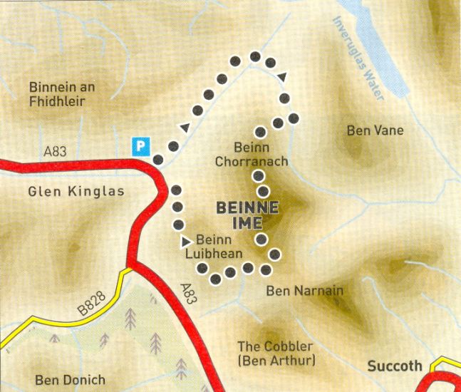
The Arrocher Alps - Beinn Ime - route map

Beinn Ime - Route Map


The Arrocher Alps - Map of Beinn Chorranach, Beinn Ime and Beinn Luibhean

Map of Beinn Chorranach,

Beinn Ime and 
Beinn Luibhean


BEINN CHORRANACH & BEINN IME - ROUTE DESCRIPTION:


Location: north of Arrochar
Map: O5 Landranger 56 [GR 255 096]
Distance: 7.5 miles ( 12km )
Time: 3 hours 15 minutes
Terrain: tracks and mountain paths

Beinn Chorranach is the quietest of the Beinn Ime massifs three main hills. The north ridge offers the finest ascent plus the option of Beinn Ime for any Munro baggers.
From the car park at Butterbridge follow the track north-west to the cottage of Abyssinia. Leave the main track, ford the Kinglas Water and ascend the track to the old cottage. Follow the small burns bank up the hillside to a deer fence. Follow good animal tracks below it east then south into Gleann Uaine. Cross over a ladder stile and ascend directly to the ridge of
Beinn Chorranach.
Follow the long ridge to the summit cairn then descend to Glas Bhealach, the col below Beinn lme, where there's a choice of routes — west down to Butterbridge or up Beinn Ime. Over Beinn Ime, a clear path leads to the summit. Continue south on a path heading for the Cobbler and Beinn Narnain, descending to the col between Ime and Luibhean, double baggers can pick up the Corbett if desired. From the pass, follow the right [east] side of the burn draining north from the col to descend into the corrie below Ime's west face and below the Glas Bhealach. Follow the
burn down then cross to the west side and a rough path between the burn and felled forestry.
Descend to an aerial on a hillock on the left. Cross a fence to gain the aerial, from where a track leads down to the road. Pick the driest line to gain the old tarmac road in the floor of the glen, and follow it back over General Wade's Butterbridge to the car park.


The Arrocher Alps - Beinn Ime - route map

Beinn Ime - Route Map


The Arrocher Alps - Beinn Ime, Ben Arthur ( Cobbler ) , Beinn Narnain


Map of the Arrochar Alps

Map of the Arrochar Alps


 Beinn Ime & Beinn Luibhean Gallery Photo Gallery

<< BackSouthern Highlands Index : Next >>


Scotland Index :: Scottish Peaks

Glencoe | Ben Nevis | Knoydart | Isle of Skye | Isle of Arran | The West Highland Way

The Eastern Highlands | The Central Highlands | The Southern Highlands | The NW Highlands


Adventure Travel : Worldwide Mountaineering : Site Index

fb icon  google+ icon  Linkedin icon  twitter


Travel & Guide Books & Maps - Scotland:-


Arrochar Alps - Map Glasgow Popular Hills - Map West Highland Way - Map Loch Lomond North - Tyndrum, Crianlarich, Arrochar - OS Explorer Map Loch Lomond and Inverary OS Landranger Map

Isle of Arran OS Explorer Map Isle of Arran OS Landranger Map Arran - Official Tourist MapIona & Mull MapWestern Scotland & the Western Isles OS Road Map Northern Scotland OS Road Map Southern Scotland OS Road Map


Walking the Munros - Southern, Central & Western Highlands 

The High Mountains of Britain & Ireland  Munros Tables SMC  The Munros - Scotland's Highest Mountains  Scotland - Lonely Planet  NW Highlands - SMC Guide  Exploring the Far NW of Scotland  Guide to Walks in NW Highlands

Walking in Scotland - Lonely Planet Mountain: Exploring Britain's High Places  National 3 Peaks Walk Scottish Highlands Hillwalking Guide The Scottish Islands Bouldering in Scotland

Central Highlands: Six Long Distance Walks West Highland Way: Official GuideWest Highland Way: Rucksac Readers West Highland Way: TrailblazerThe West Highland WayWest Highland Way: Footprint MapWest Highland Way - Map West Highland Way - Map 100 Hillwalks around Glasgow

Pathfinder Guide: Fort William and Glen Coe Walks Rambler's Guide: Ben Nevis and Glen CoeGlencoe Rock & Ice Climbing The Munros: Scottish Mountaineering Club The Munros and Tops The Corbetts - SMC Munros & Corbetts Chart The High Mountains of Britain and Ireland Munro Almanac

The Munros - Scotland's highest mountains Call of the Corbetts Magic of the Munros Hamish's Mountain WalkThe Munros in Winter My Scotland by Hamish MacInnes

Scottish Mountains - 50 Classic Routes50 More Routes on Scottish Mountains The High Mountains of Britain and Ireland Scotlands 100 Best Walks Scottish Mountains - 100 Best RoutesBig Walks of Great Britain Classic Walks in Britain & Ireland

Scottish Hill & Mountain Names Classic Mountain Scrambles in Scotland Classic Climbs - Central & Southern Highlands Mountaineering in Scotland and Undiscovered Scotland by W.H.MurrayMore Wilderness Walks Wilderness Walks Wilderness Walks 2 - Video Ski Mountaineering in Scotland

Ski Touring in ScotlandScrambles in Lochaber Rock Climbing in Scotland Rock Climbing SkillsThe FACE: Six Great Climbing Adventures Ben Nevis: Rock & Ice ClimbsGreat Snow & Ice Climbs of the British Isles100 Best Routes on Scottish Mountains One Man's Mountains - Tom Patey

A Mountaineer's Tale - W.H.Murray Dougal Haston: Philosophy of RiskThe Glens of Rannoch Southern Highlands - MapNorthern Highlands Central Highlands West Highlands Central Highlands SMCNW Highlands SMC

Scotland - Lonely PlanetScotland's Highlands & Islands - Lonley Planet Scotland's Highlands & Islands - Rough Guide Highlands & Islands of Scotland - Hidden Places Rough Guide Scotland Scottish Highlands & Islands - Rough Guide Rough Guide: Scotland Lonely Planet, Walking in ScotlandLonely Planet - Walking in Britain

50 Walks in the Scottish Highlands & Islands 100 Walks in ScotlandVisit Scotland - Touring Guide Scotland: Where to Stay - Hotels & Guest Houses Scotland: Where to Stay - Bed & Breakfast Hillwalker: The MunrosHillwalker: The Corbetts

Weather for Hillwakers & Climbers Mountain Weather Guide to the Weather Weather: Collins Gem Hillwalking Handbook for Mountain Leaders Hillwalkers Manual Hillwalkers Guide to Mountaineering First Aid on Mountains


Google Analytics


Google Analytics

extremetracking
 eXTReMe Tracker


extremetracking
Sitelock caingram.com
SiteLock
Sitelock
Sitelock caingram.info
SiteLock
Sitelock